


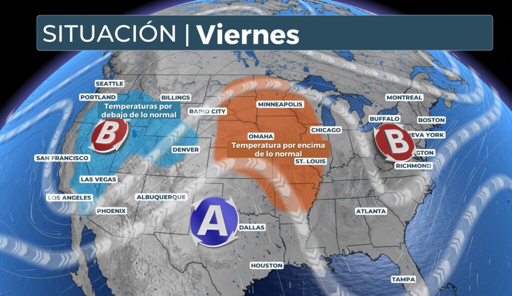
The stagnant weather pattern has changed. Now, a Omega lock affects the continental U.S. This phenomenon brings back summer temperatures. It also brings much needed rainfall to the Pacific Northwest.
A Omega lock is an atmospheric pattern. It occurs when a large area of high pressure is sandwiched between two areas of low pressure. This makes it resemble the Greek letter Omega (Ω) on weather maps.
This blocking is developing late in the week. High pressure has returned to the central U.S. This is lifting temperatures above 32°C. In the Pacific Northwest, an area of low pressure is bringing intense thunderstorms. This region is experiencing one of its hottest and driest summers on record.
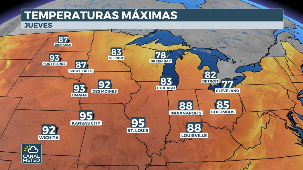
Temperatures near 38°C in parts of the central US.
After weeks of wet weather, summer returns. On Thursday, temperatures will reach the upper 30s in the southern Plains. They will extend all the way to St. Louis. Even Chicago could reach 26°C.
By Friday, 150 million Americans will feel the heat. Temperatures will be 5 to 8°C above average. It will feel like midsummer. The warm weather will continue through Monday.
High pressure over the center of the country will affect the path of the storms. Storms will move westward into Canada. They will then descend to the east coast. As a result, the northeast will remain cooler than normal through Monday.
Rains to bring relief from wildfires and flash flood risk in Pacific Northwest
Parts of the Pacific Northwest are already receiving some rain. The Omega block will bring a second, more intense round of storms. It will move into the region on Thursday.
This rain will be beneficial to the Northwest. Much of the area is in drought, according to the U.S. Drought Monitor. The region has had one of its driest and hottest summers on record.
Blockade to bring much-needed rain to the Northwest
The Pacific Northwest is experiencing one of its 10 hottest and driest summers. Wildfires have been burning with little or no containment, and smoke has blanketed the region for days. The region will see rain over the weekend, which should help firefighting efforts.
NOAA's NOAA Weather Prediction Center has issued a risk of flooding Level 1 (of 4) thunderstorms across much of the northwest and northern Rocky Mountains through Sunday morning. Twenty-five to 50 millimeters of rain is expected over a wide area through the weekend.
A Flood Watch is in effect for parts of Oregon, with the potential for debris flows due to excessive rainfall over recent fire scars.
Parts of the northern Rocky Mountains and northern plains have been placed under a Level 2 (out of 5) risk of severe weather on Thursday, according to the Storm Prediction Center from NOAA. This includes parts of Montana and North Dakota.
Wildfires, many of which have been caused by dry lightning strikes, are burning throughout the region with little or no containment due to dry conditions.
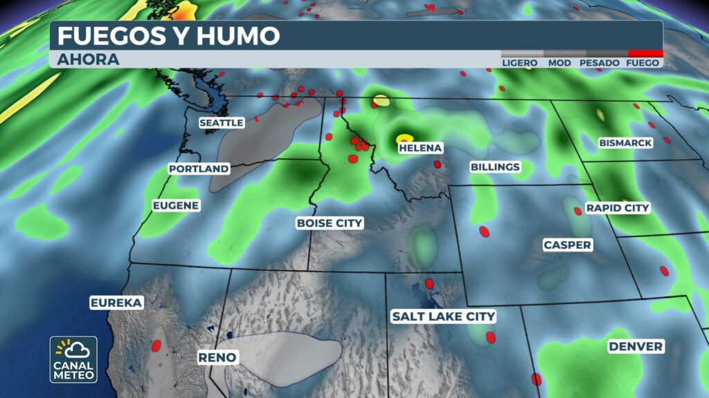
Smoke from these fires has created air quality problems in Washington, Oregon, Idaho, Montana and Wyoming at various times this summer.
The weekend rains should help firefighting efforts.
This year has been one of the driest summers in history for the Pacific Northwest.
Precipitation is likely too far north to help quell the Garnet Fire, which triggered Dense Smoke Warnings in parts of central California and Nevada earlier this week.


