

Estado actual y evolución esperada
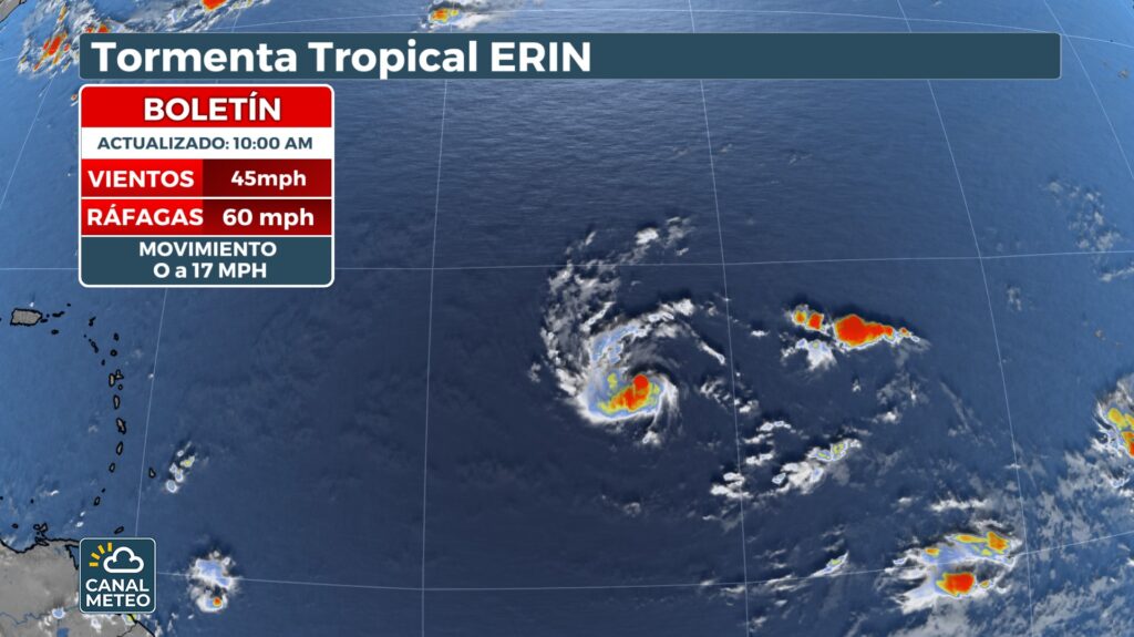
- Formación y desplazamiento actual: Erin se formó el lunes en el Atlántico oriental y actualmente mantiene vientos sostenidos de aproximadamente 45 mph (≈ 75 km/h), desplazándose hacia el oeste a unos 30–32 km/h. Se ubica a más de 1 200 millas al este de las Islas de Barlovento, moviéndose sobre aguas cada vez más cálidas .
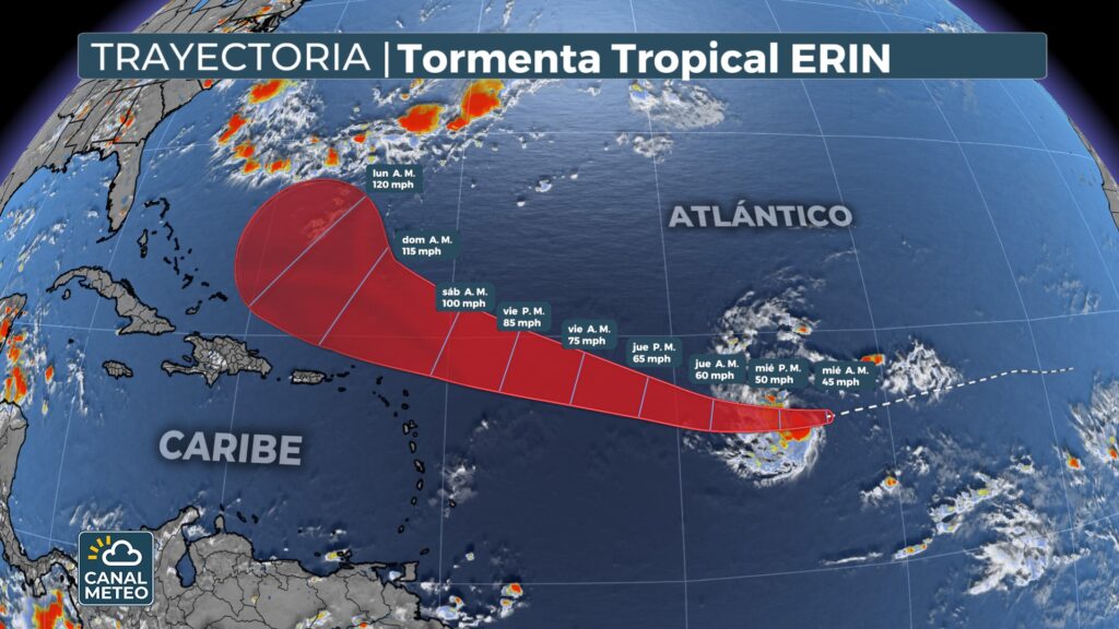
- Fortalecimiento previsto: Se anticipa que se intensificará en los próximos días, alcanzando probablemente categoría de huracán entre el jueves y el viernes. Hay proyecciones que indican que podría convertirse en un huracán importante (categoría 3 o superior) hacia el fin de semana .
Trayectoria y áreas en riesgo
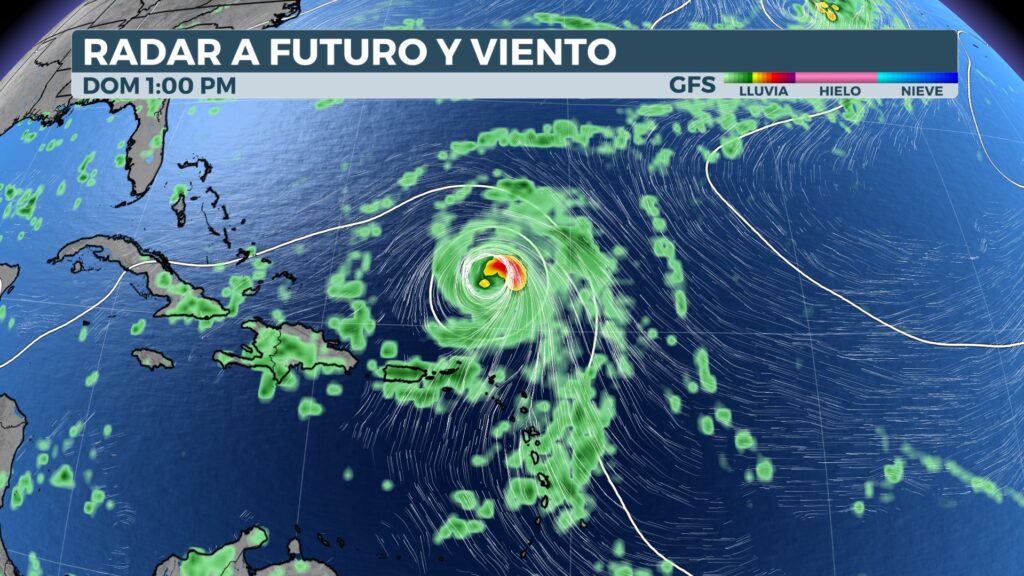
- Erin sigue un curso predominantemente occidental. Se espera que gire hacia el noroeste a medida que avanza, pasando cerca o justo al norte de las Islas de Barlovento, Puerto Rico y las Islas Vírgenes .
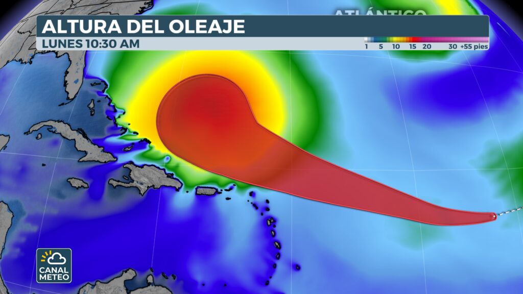
- Es probable que permanezca del mar, aunque sus marejadas podrían generar condiciones peligrosas como surf elevado y corrientes de resaca en las zonas costeras del Caribe y la costa este de los EE. UU. .
- Posteriormente, se espera que curve hacia el norte, evitando las Bahamas y la costa continental estadounidense. No obstante, podría afectar indirectamente, generando oleaje elevado y corrientes en las costas Bermudas y el Atlántico canadiense .
Sistemas adicionales bajo monitoreo
- En el mar Caribe, se observa una perturbación tropical en el oeste de la península de Yucatán que cruzará hacia el Golfo de México. Tiene entre un 10 % y 20 % de probabilidades de desarrollo en los próximos días. Aunque su impacto directo en EE. UU. es limitado, podría traer lluvias dispersas a Texas, incluyendo Houston, entre jueves y viernes .
Resumen técnico estilo canal meteorológico
| Elemento | Detalles principales |
|---|---|
| Formación | Se formó el lunes en el Atlántico oriental. |
| Intensificación | Se espera que llegue a ser huracán entre jueves y viernes; posible categoría 3 el fin de semana. |
| Trayectoria | Oeste y luego noroeste; puede pasar al norte de las Antillas y Puerto Rico. |
| Impacto directo | Poco probable, pero se esperan oleaje fuerte y condiciones peligrosas en playas. |
| Sistemas adicionales | Perturbación tropical en el Caribe con baja posibilidad de desarrollo. |