


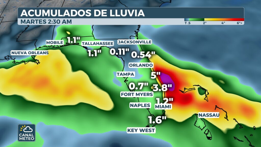
Florida experiences a contrast this season: while the Gulf coast suffering from dry conditions, the east coast faces heavy rains. Part of the Atlantic seaboard could receive up to 8 inches (about 20 cm) rain until Monday due to the combination of a stagnant cold front and an area with possible tropical development.
Important points
Tropical threat off the east coast
Although the likelihood of a tropical system forming is low, tropical moisture coupled with the stagnant atmospheric front will maintain persistent rainfall throughout the weekend, raising the risk of flash flooding. Some areas could accumulate more than half a foot of rain.
The flood threat is expected to begin developing from Thursday and peak around Monday.
Risk of flooding and accumulations
A flood threat level has been issued. 1 of 5 for much of the Atlantic coast of Florida and southeast Georgia. Overall rainfall could range from 3 and 5 inches (about 7.5 to 12.5 cm)with isolated accumulations of up to 8 inches in coastal areas. Coastal affiliates such as Treasure, Space and First will receive some of the heaviest rainfall in the state.
On the other hand, persistent flow from the sea may increase the risk of coastal flooding in low-lying areas and worsen flooding conditions. dangerous currents.
Internal climatic contrast
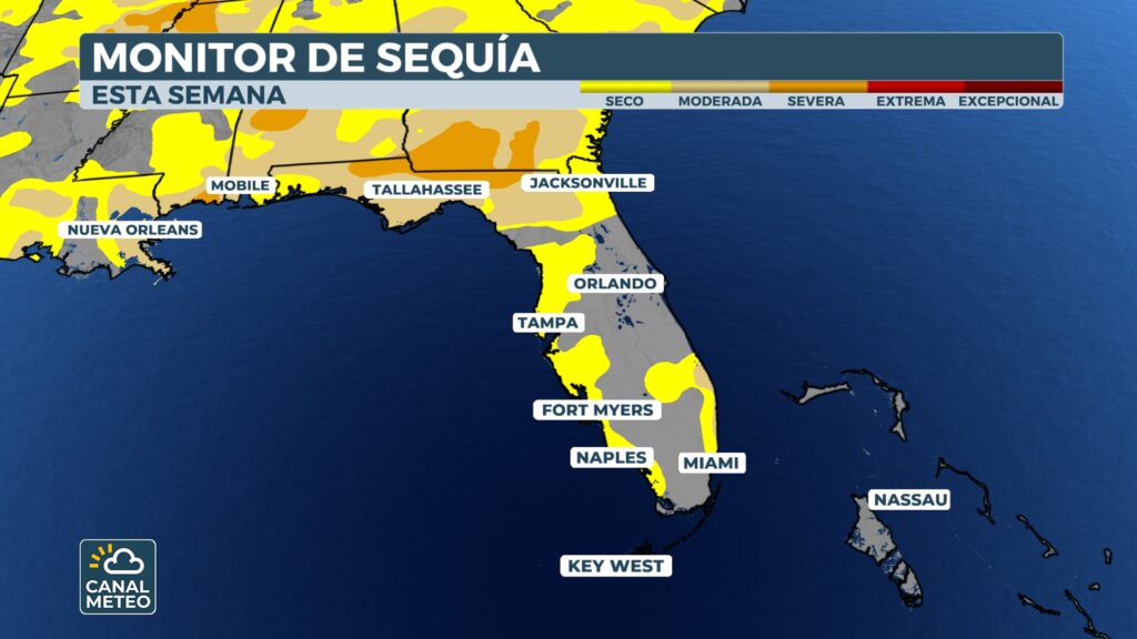
Not all of Florida has become a rainy state: the Gulf Coast is experiencing fairly dry conditions. For example, Tampa recorded one of its driest Septembers with less than an inch of rain; Tallahassee also reported scant precipitation. Meanwhile, on the East Coast, Miami recorded 16.52 inches, making it one of its wettest Septembers in decades, and Daytona Beach surpassed the foot-of-water barrier, marking its 10th wettest September on record.


