


Fourth of July celebrations and beach plans could be affected by the arrival of a tropical-like system developing off the southeast coast of the United States.
Important points
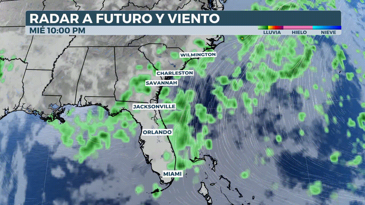
A stationary front, combined with warm Atlantic waters, is generating persistent showers, thunderstorms and unstable conditions in Florida, Georgia and the Carolinas. Although there is no named storm yet, the National Hurricane Center is indicating a average probability of tropical development in the coming days.
Fourth of July celebrations and beach plans in Florida and the southeastern United States could be disrupted due to a combination of a weakening front and the possible formation of a tropical system in the western Atlantic.
Most of the precipitation recorded in Florida so far has been related to daily showers and thunderstorms, intensified by an upper-level low that has enhanced atmospheric activity.
What to expect?
- Accumulated rainfall between 1 and 5 inches, with locally higher spots.
- Severe storms with strong winds and sea sleeves reported.
- Increased risk of urban flooding and coastal erosion.
- Dangerous undertow currents as low pressure builds off the coast.
During the next few days, a cold front will move southward and stall over warm waters of the southwest Atlantic, which could favor tropical development.
The National Hurricane Center has pinpointed a region off the coasts of the Carolinas, Georgia and Florida with a medium probability of tropical formation over at least the next seven days.

Rainfall and possible impacts even if no storm forms
Although there is uncertainty as to whether the system will become organized, forecasters indicate that the main issue is not whether it becomes a named storm, but the risks of persistent coastal erosion and localized heavy rainfall.
"We are watching a front descending over Georgia and the Carolinas. If the low pressure system stays over the warm waters long enough, it could attempt to develop, but even if it doesn't, we will still expect a very rainy weekend," experts explain.
Accumulations of 1 to 4 inches of rain have already been recorded in the region, with an additional 1 to 5 inches expected over the remainder of the holiday week, with locally higher amounts.
In addition to heavy rains, waterspouts and damaging gusts of wind associated with strong storms have been reported, phenomena that will continue during the next few days.

Increasing coastal risks
Up to now, the undertow currents and beach erosion have not been a serious problem, but as more ocean movement is generated and low pressure begins to build off the Georgia coast, those risks will increase.
Specialists stress that, whether or not it becomes a depression or tropical storm, the general weather effects will be practically the same.
What to expect from the Atlantic in July?
If the cyclone were to be named, it would receive the name of Chantalthe third name of the season.
Depending on the criteria used, the Atlantic basin may appear more active than usual or lag behind in terms of overall intensity.
Although two tropical cyclones have already formed this year, their impacts have been minimal, their duration short and their contribution to seasonal energy practically nil.


