


Could a tropical depression or tropical storm form right in the middle of the 4th of July celebration?
The atmosphere does not take a vacation. While thousands of people celebrate the Independence Day in beaches and cities in the southeastern United States, a system under investigation - designated as the Invest 92L- has been keeping meteorologists and residents on alert since Florida to the Carolinas.
Important points
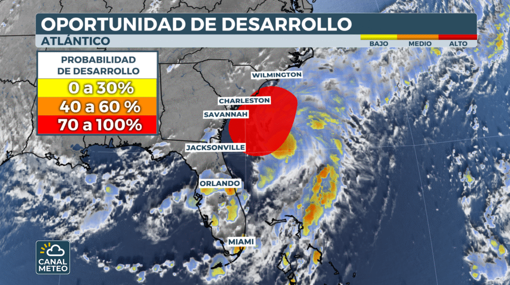
The National Hurricane Center (NHC) monitors this area of storms off the coast of South Carolinawhich could become a tropical or subtropical depression between Friday and the weekend. Although this system is not expected to become a cyclone of great intensity, it is certain that heavy rains are already affecting several regions of the country..
What is Invest 92L?
A "Invest" is an area that meteorologists are watching closely for its potential to develop into a tropical storm over the next seven days. It has no official name (as hurricanes do), but it is the first step toward the possible formation of a tropical storm. tropical storm.
Will Tropical Storm Chantal form?
If sustained winds reach 40 mph (64 km/h) over the ocean, the system would receive the name of Chantalthe third in the list of names of the Atlantic 2025.
Although it is too early to confirm its trajectory, meteorological models, including the new models with artificial intelligence, agree that the formation center would be in front of the Georgia coast. The system will probably will follow a course parallel to the coast of the Carolinas towards the open sea. early next week.


