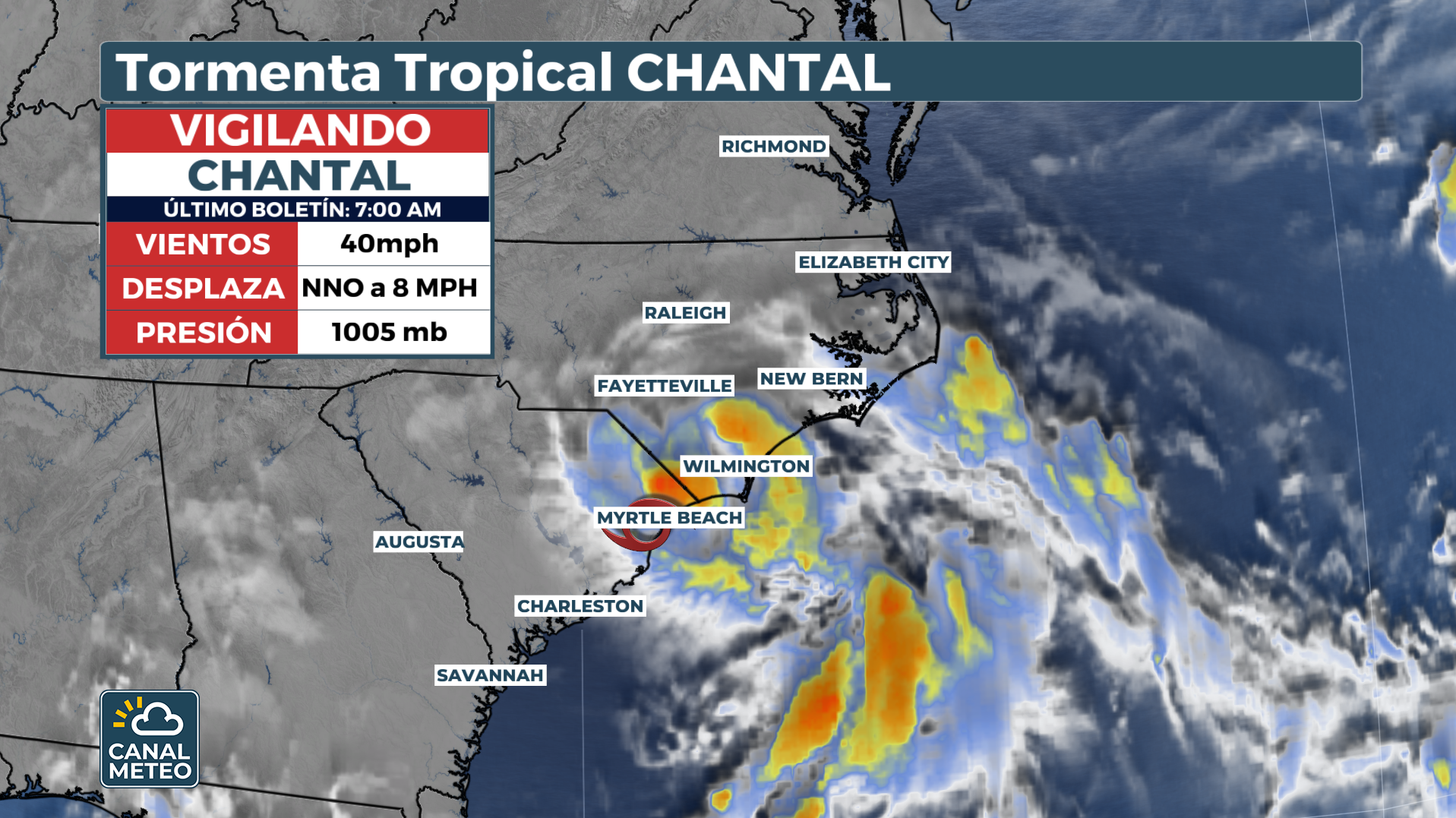
Tropical Storm Chantal made landfall at Litchfield Beach, South Carolina, early Sunday with maximum sustained winds near 50 mph (80 km/h). Since then, the system has begun to weaken rapidly as it slowly moves inland across the state.
Local authorities have warned of dangerous surf, storm surges and possible flash flooding in the coastal region. Lifeguard organizations in the Grand Strand area reported several rescues due to dangerous ocean conditions.
According to the latest bulletin of the National Hurricane Center (NHC), Chantal maintains sustained winds of 40 mph (65 km/h) and is expected to continue to weaken over the next few hours.

Warnings and risks
Tropical storm warnings remain in effect from South Santee River, South Carolina, to Surf City, North Carolina.
The most significant impact will be localized heavy rainfall, especially in areas near the storm's center entry point north of Folly Beach. Rainfall accumulations could reach 2 to 4 inches (5-10 cm), with isolated amounts up to 6 inches (15 cm), significantly increasing the risk of urban and rural flooding.
In addition, a 1-2 foot storm surge is anticipated from South Santee to Surf City, which could flood normally dry areas near the coast.

There is also a chance of isolated tornadoes during Sunday in eastern North Carolina and extreme northeastern South Carolina.
Sea conditions will continue to be dangerous, with strong swells and undertow currents that can be life-threatening.


