


If the storm evolves as forecast, it could become one of the wettest Novembers in Los Angeles in the last 50 years.
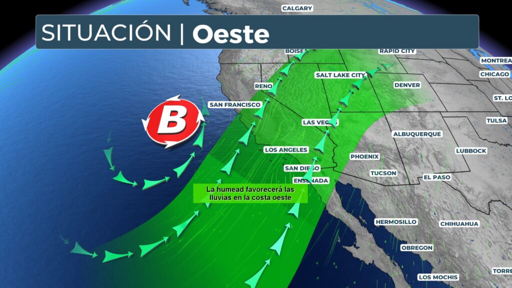
A powerful atmospheric stream began to impact California, The rainy season is expected to continue, with several days of heavy rain, strong wind gusts and potentially several feet of snow in the mountainous areas. This episode marks the beginning of the rainy season in the region.
The system could dump several months' worth of rain on Southern California in just a few days, while the Bay Area and Northern California remain at risk of flash flooding during Thursday.
What is an atmospheric river?
During Thursday morning, heavy rains affected rush hour in San Francisco, complicating mobility. At San Francisco International Airport, a brief suspension of operations was issued due to high winds.
Downstate, the city of Los Angeles issued evacuation warnings in areas near the Hurst and Sunset fire scars from the January wildfires. Evacuation orders were also issued in areas around Mandeville Canyon, within the perimeter of the Palisades Fire.
What is a fire scar and why does it increase the risk of flooding?
The ash left by fires generates a hydrophobic layer on the ground, making it difficult for water to be absorbed. This makes burned areas especially vulnerable to flash flooding and debris flows. Throughout Thursday morning, Los Angeles firefighters went house-to-house in Pasadena, alerting residents in high-risk areas.
Rain is expected to advance along the California coast and into the Central Valley during Thursday, with the possibility of thunderstorms and severe gusts near the coast.
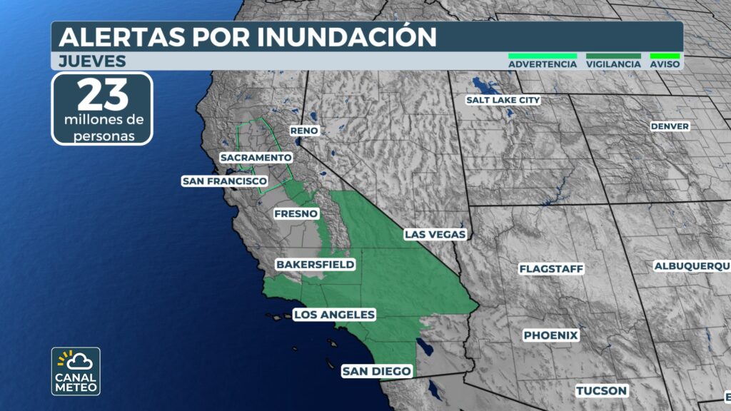
The U.S. Weather Prediction Center maintains two areas under moderate risk (Level 2 of 4) for flash flooding: one that includes San Francisco and the Bay Area, and another that covers Sacramento, parts of the Shasta Cascades, Sierra Nevada and Gold Country.
The heaviest rain will move south of the state between Thursday night and Friday morning. A second round of precipitation is forecast for Friday afternoon and evening.
Overall, 3 to 5 inches of rain (75 to 125 mm) is estimated for parts of the coast, including San Francisco and Los Angeles, with isolated areas that could receive 5 to 8 inches (125 to 200 mm). The San Gabriel and Santa Monica Mountains could also accumulate 5 to 8 inches.

If the storm meets projections, Los Angeles could record one of the wettest Novembers in five decades.
Meanwhile, winter weather alerts remain in effect in the Sierra Nevada through Friday. Some of the highest mountain passes are already closed for the season. At the peaks, wind gusts could exceed 100 mph (160 km/h).
To watch Canal Meteo you can do it at this link.


