


The risk of heavy rains and severe thunderstorms will return to much of Texas over the weekend, although the worst of the storm is expected to move to the northfar from the areas recently affected by the historic floods of July 4.
Given that the terrain in the Central Texas (Hill Country) remains saturated and extremely vulnerable, the population is advised to be especially vigilant to any storm that develops in the region.
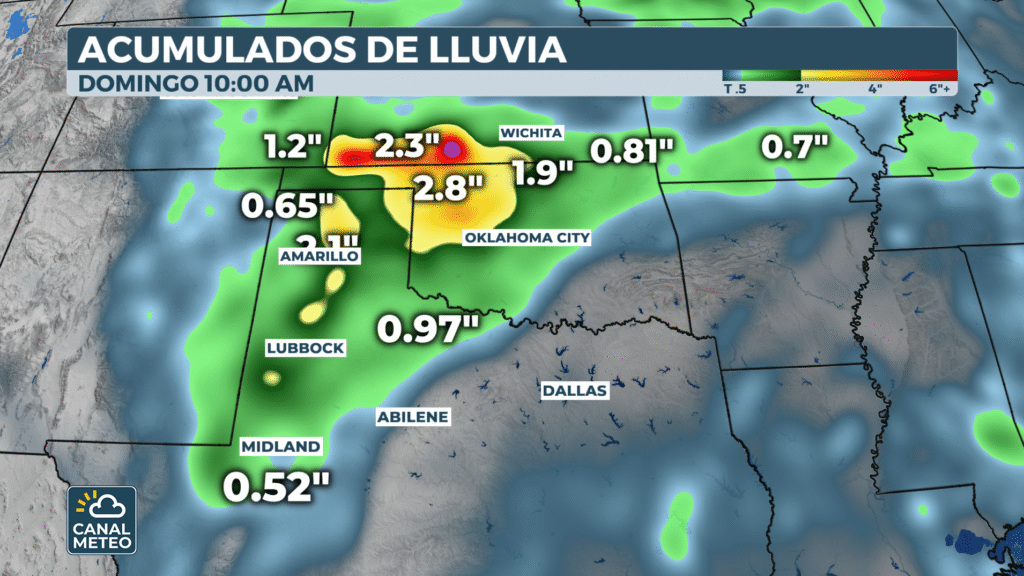
Forecasts call for thunderstorm complexes to form Saturday afternoon in parts of the Panhandle, Big Bend and North Texasespecially at the eastern edge of the heat dome that continues to affect much of the western US.
These storms could bring flash floodingand damaging gusts of wind and hail. Cities such as Amarillo, Lubbock, Midland, Abilene and Dallas are under risk of thunderstorms from this weekend through early next week.
Flash Flood Risk - Saturday, July 12, 2025
The Weather Prediction Center has issued a Level 2 of 4 on the flash flood hazard scale for the West, the Panhandle and North Texas.
Meteorological models indicate that some areas could receive between 5 and 10 centimeters of rainThe most intense precipitation would remain north of the Hill Country, although most of the heaviest precipitation would remain north of the Hill Country.
"The problem is that the soil is already totally saturated. In some areas, less than 1 cm of rain will be enough to cause new flooding," explained a local meteorologist about the areas most affected by the recent rains.
In addition, atmospheric humidity levels are forecast to reach values in the 90th percentile for this time of yearespecially north of the Interstate 20This increases the potential for heavy rains in a short period of time.


