


A powerful storm of great extension is crossing the United States from west to east. They are hurricane-force winds, heavy rains and snowfall. Will affect more than 30 states before the end of the week, just when traffic increases due to pre-holiday travel.
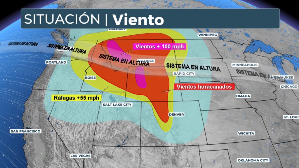
The system begins to abandon the northwest of the country, where heavy rains have exacerbated the floods historical records in Washington, D.C. last week. Advances to the Northern Great Plains and Rocky Mountains. Widespread wind gusts are being recorded in these regions of 50 to 70 mph (80-110 km/h), with isolated values that could approach 80-90 mph (130-145 km/h).
Conditions for driving and air travel are deteriorating rapidly in the United States. Montana, Idaho, Wyoming and the Dakotas. Due to strong winds and snow. In elevated and exposed areas, gusts have reached extreme values, 71 mph at Whidbey Island (Washington) y up to 138 mph at Mt. Hood (Oregon).
The strong gusts have worsened the power outages already existing flooding in Washington, where more than 350,000 customers were without power. While Oregon recorded more than 200,000 affected.
As the storm progresses eastward, it will continue to leave heavy rains, strong winds and snow on its route. The National Weather Service has issued high wind warnings and alerts in large parts of the northern part of the country. The combination of snow and wind is causing zero visibility conditions on the road.
In parts of Colorado, The strong winds descending from the Rocky Mountains, combined with dry conditions. They have raised the risk of forest fires, This has led to the issuance of critical fire weather alerts.
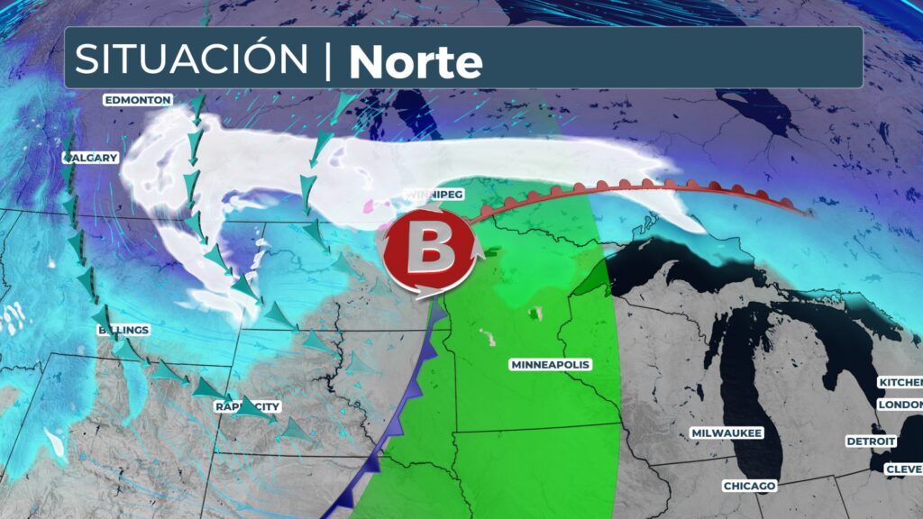
Looking ahead to Thursday, the low pressure center will move near the U.S.-Canada border. A fast moving cold front will move southward. Expect snowfall and gusts above 50 mph in the Dakotas, Minnesota and Iowa, with very hazardous travel conditions. In parts of the Midwest, rain will give way to snow throughout the day.
On Friday, the system will reach East Coast, with widespread rainfall from New England to Florida. In the northeast, there could be isolated flash flooding due to snowmelt and soil saturation. In Vermont, New Hampshire and Maine. Also expected snowfall due to lake effect in areas near the Great Lakes.
Further south, the warmer air could favor the development of severe storms in parts of Kentucky and Tennessee.
This episode confirms the seasonal forecasts that pointed to a very active start of the meteorological winter. The weather pattern of La Niña, The weather is usually more intense in the United States, which favors a more intense jet stream and marked thermal contrasts.


