


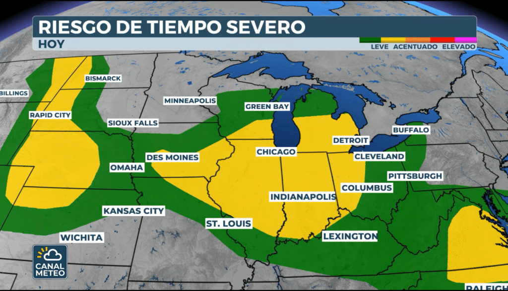
The weekend kicks off with strong storm activity in the Midwest and Great Lakes. Expected severe thunderstorms, heavy rains and possible hail and tornadoesaffecting densely populated areas such as Chicago, Detroit, Milwaukee and Indianapolis.
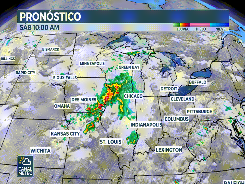
During the early morning hours of Saturday, thunderstorms were already being recorded over Iowa, and the system is moving eastward. It is a mesoscale convective system (MCS) which could remain active for hours, increasing the risk especially in the areas closest to its origin.
Radar animation of the last 3 hours showing active warnings (yellow boxes for severe storms, red for tornadoes, green for floods, etc.).
What is a mesoscale convective system?
It is an organized complex of storms that can span hundreds of kilometers and produce severe events such as hail, intense winds and even tornadoes.
Cities in the eastern part of the risk zone - such as Detroit, Erie, Cleveland and Fort Wayne- could be affected by more scattered thunderstorms during the afternoon, although with a risk of heavy rain.
OTHER AREAS ON ALERT
In addition to the Midwest:
- In the Plains: Risk of large hail (as large as baseballs!) from eastern Montana to western Nebraska. Affected: Rapid City, North Platte and Sturgis.
- On the east coastPossible damaging winds in areas such as Richmond and Norfolk (Virginia) and parts of North Carolina.
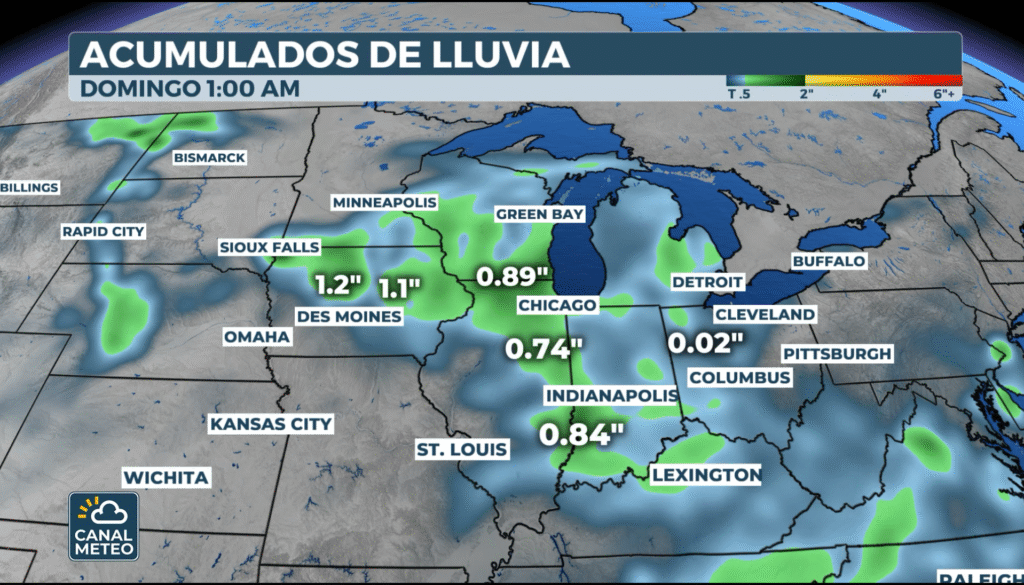
RISK OF FLASH FLOODING
Although not all storms will be severe, many will leave heavy rains. The Weather Prediction Center NOAA has issued a Level 2 of 4 for flooding from Iowa to the Atlantic Coast.
From CanalMeteo.tvwe recommend:
- Watch for weather updates throughout the day.
- Have a safe shelter identified in case of a storm.
- Avoid unnecessary displacements in at-risk areas.
The storm season is still active.Find out more and get ready with us!


