


More of 92 million people in more than 20 states are currently under excessive heat alert or heat advisoryaccording to meteorological services. The most intense heat wave is expected to move towards the Interstate 95 corridoraffecting cities such as Washington D.C., New York and Bostonwhere the heat index could exceed 100 °F due to a tropical air mass with high humidity levels.
Important points
Maximum temperatures will be around 90 degrees in these areas, but the wind chill will be significantly higher. Philadelphia is located under a extreme heat warningand other cities in the northeast, such as Boston, Providence and Hartfordare under advisories until at least Friday.
Impact of heat: Children at risk
One of the most tragic aspects of extreme heat is the risk it poses to children accidentally left in hot vehicles. Since 1998, more than 1,000 children have died in the United States from heat stroke under these circumstances. This year alone, 16 minors have lost their lives, including a recent case in Alabama. Awareness and prevention are key to avoiding further tragedies.
Will records be broken?
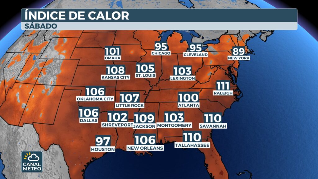
Some cities could approach or break daily temperature records. Newark, New Jerseycould reach values close to 100 °Fbreaking previous records. Although slight relief is expected on Saturday in cities such as New York and Boston, where highs will drop to the lows of the 80 degreesextreme heat will persist in the Mid-Atlanticwith thermal indexes that will continue to be above the 100 °F in places such as Washington D.C. and Richmond, Virginia.
This summer is already among the five hottest on record in more than two dozen U.S. cities, with average temperatures in the United States of 1 to 3 degrees above normal. Long-term projections indicate that the East and Northeast temperatures will continue to higher than usual for the rest of the season.
Severe storms threaten the Northeast
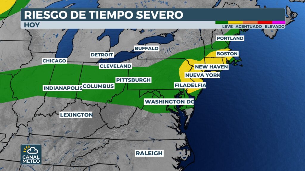
In addition to the heat, the following are expected severe weather in the North Mid-Atlantic and New England. The Storm Prediction Center warns that strong to severe thunderstorms could develop on Friday, with dangerous wind gusts as the main threat.
More of 35 million people are under a level 2 (out of 5) risk for storms, including the cities of New York, Philadelphia, Boston, Boston, Newark and Jersey City.
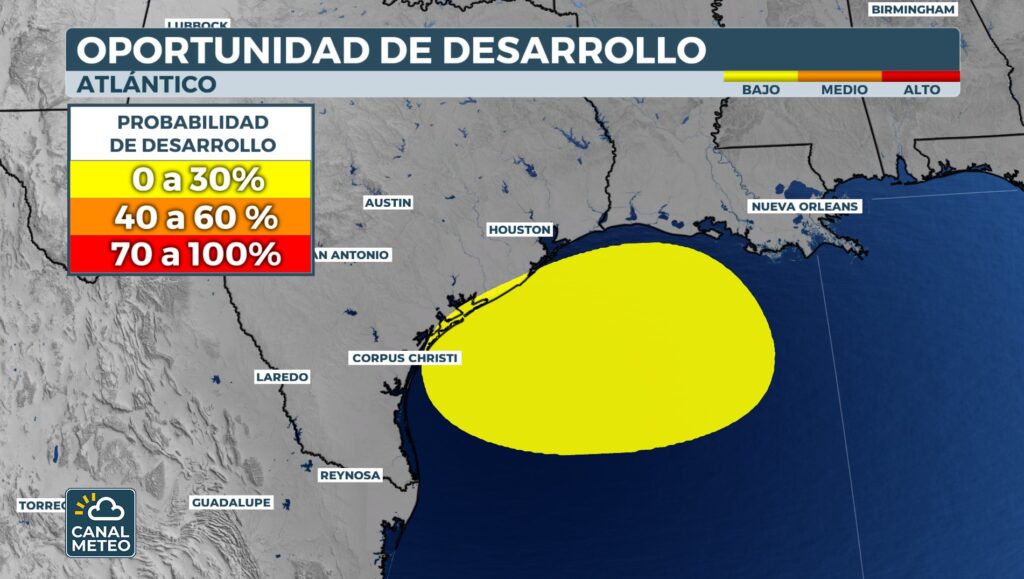
Possible tropical development in the Gulf of Mexico
In the meantime, a low pressure system over the Gulf of Mexico has been generating heavy rains and disorganized thunderstorms. Although conditions for tropical development are limited and the weather is running out, meteorologists are not ruling out a slow formation as the system moves towards the westapproaching the mainland.
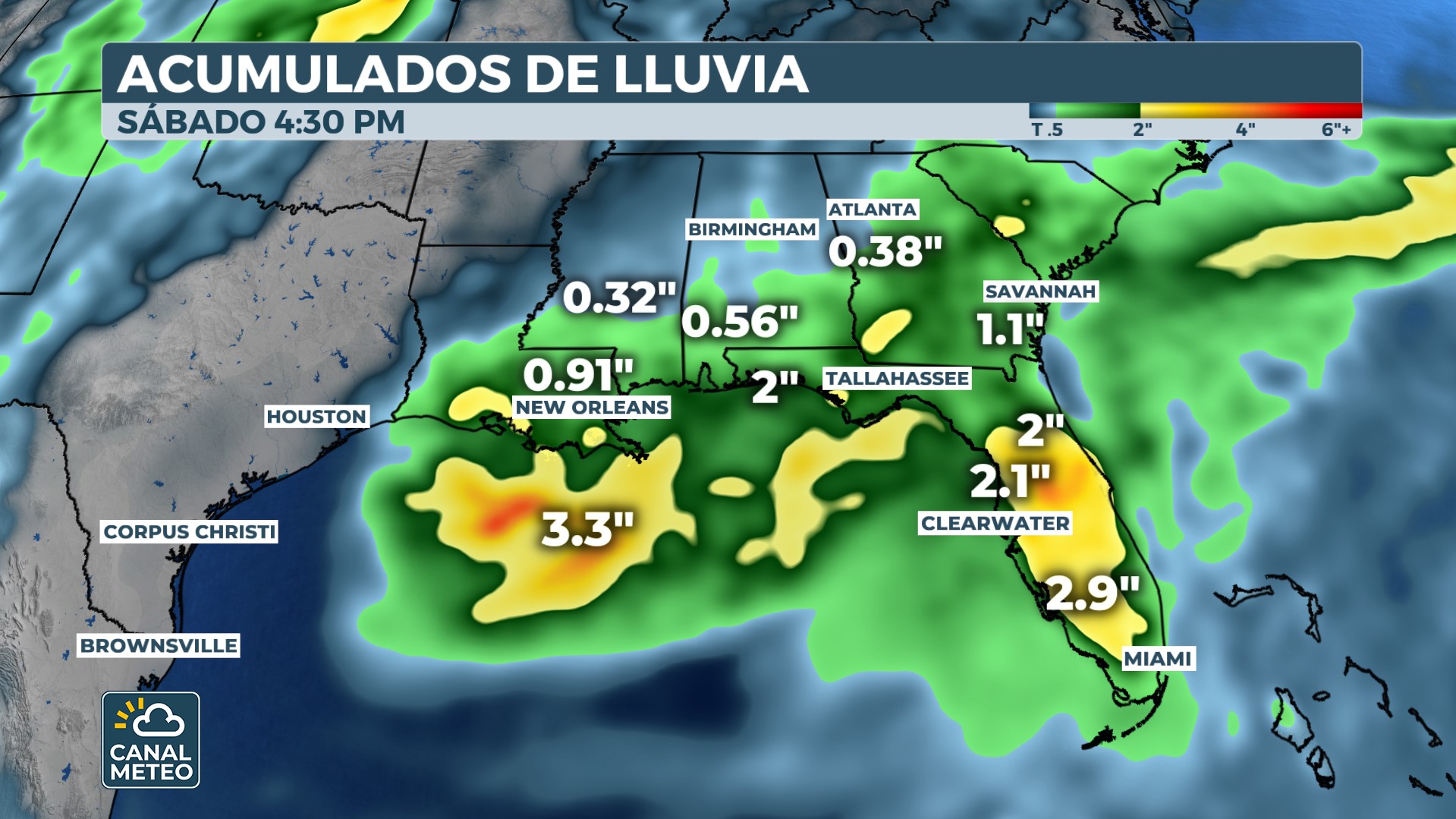
A reconnaissance mission with hurricane hunter aircraft was originally planned, but was cancelled due to the disorganization of the system. The tropical development window will close this weekend as the system moves inland, but regardless of how it evolves, the following is expected localized heavy rain for large areas of the northern Gulf coastfrom Louisiana to the Florida Panhandle.
📌 Recommendations.
- Avoid prolonged exposure to the sunespecially between 11 a.m. and 4 p.m.
- Hydrate constantlyeven if you do not feel thirsty.
- Never leave children or pets in closed vehicles.
- Pay attention to storm warnings and have an emergency plan prepared for wind and flood risks.
Stay informed and follow the official reports in your city.


