


Erin becomes the first major hurricane of the Atlantic season 2025
Explosive intensification: Erin has become a Category 5 hurricane, with sustained winds of up to 160 mph (≈ 255 km/h), following rapid intensification in just one day.
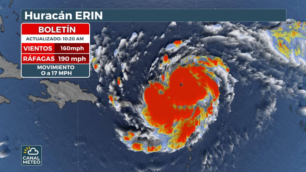
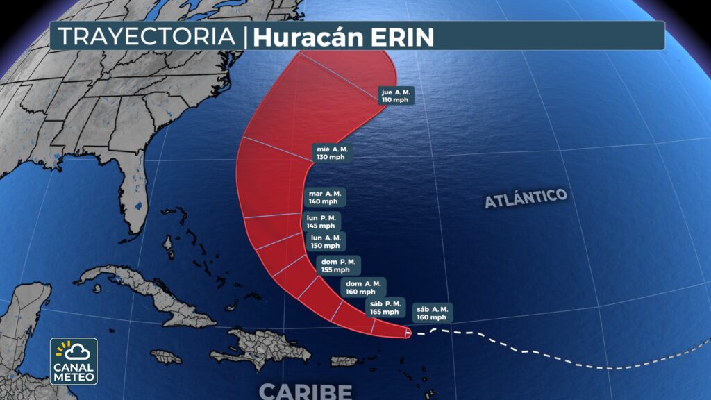
Location and track record: Moving west-northwest at about 17 mph (27 km/h), located approximately 105 miles (170 km) northeast of Anguilla.
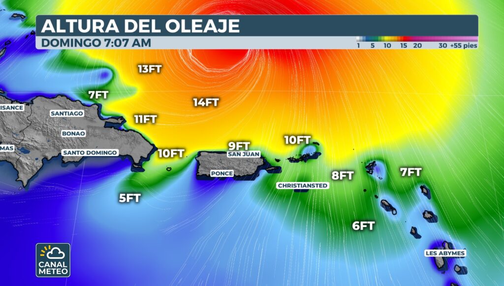
Risks in the Caribbean: Although not expected to make landfall, its outer bands are causing heavy rains, possible flash flooding and landslides in the northern Leeward Islands, Puerto Rico and the Virgin Islands.
Alertness and vigilance: Tropical storm warnings have been issued for islands such as St. Martin, St. Barts, Anguilla and Barbuda.
Widespread marine threatsDangerous swells and rip currents are expected to propagate toward the Bahamas, Bermuda and the U.S. East Coast, including areas such as North Carolina, Long Island and Cape Cod.

Climate changeErin's rapid intensification is linked to ocean warming and increased atmospheric humidity, both of which are becoming more frequent due to climate change.
Active seasonErin marks the first major hurricane of the 2025 season. An above-average season is expected, with between 18 named storms and up to five major hurricanes according to some projections.
You can retrieve our podcast Atmospheric turbulence to be always informed and prepared during the hurricane season.


