


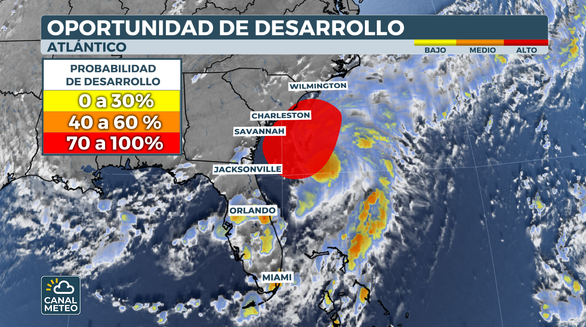
The National Hurricane Center said a broad area of low pressure off the southeast coast has been officially designated Tropical Depression Three, which could produce torrential rains across the Carolinas over the next several days.
It is expected that the system, previously designated as Invest 92LThe rainy season is expected to bring tropical rains to the southeastern Atlantic coast, regardless of their intensity.
A tropical storm warning has been issued for some coastal communities in South Carolina ahead of impacts from the system, which is expected to become Chantal within the next 24 hours.
The NHC has issued warnings from Edisto Beach, South Carolina, to Little River Inlet, South Carolina, with landfall expected on

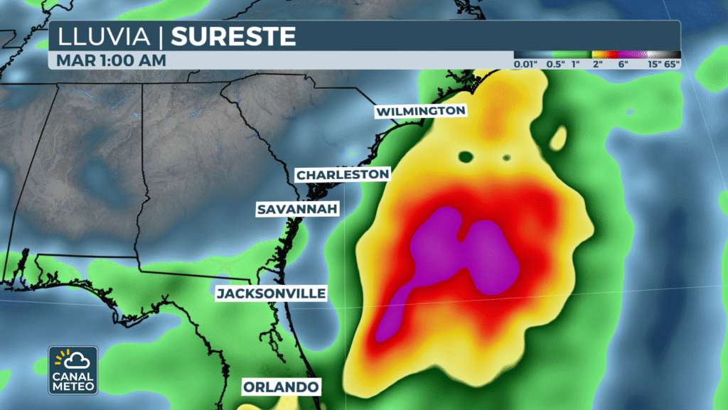
Already, pockets of rainfall in excess of 12.7 cm have been recorded in Florida and coastal Georgia and the Carolinas. Additional significant rainfall is expected next week, especially in eastern North Carolina.
The hurricane hunter aircraft investigated the system on Friday and determined that it had gained enough organization to be classified as a tropical depression.Due to the limited time the system spends over water, the cyclone is not expected to strengthen beyond a minimal tropical storm with winds between 40 and 50 mph.Once it makes landfall, the system is expected to slowly disintegrate while over the Carolinas.The tropical storm warning includes Charleston, Georgetown and Myrtle Beach and will likely be upgraded to a tropical storm warning as the event approaches in time.

Chantal would be the third named storm of the season, which normally does not occur until early August.
"Affected areas along the southeast coast of the United States should monitor the progress of this system. Additional warnings and watches are likely to be required for portions of this area tonight and Saturday," stated the NHC.


