Hurricane Erick rapidly intensifies into a major cyclone before making landfall on Mexico's Pacific Coast
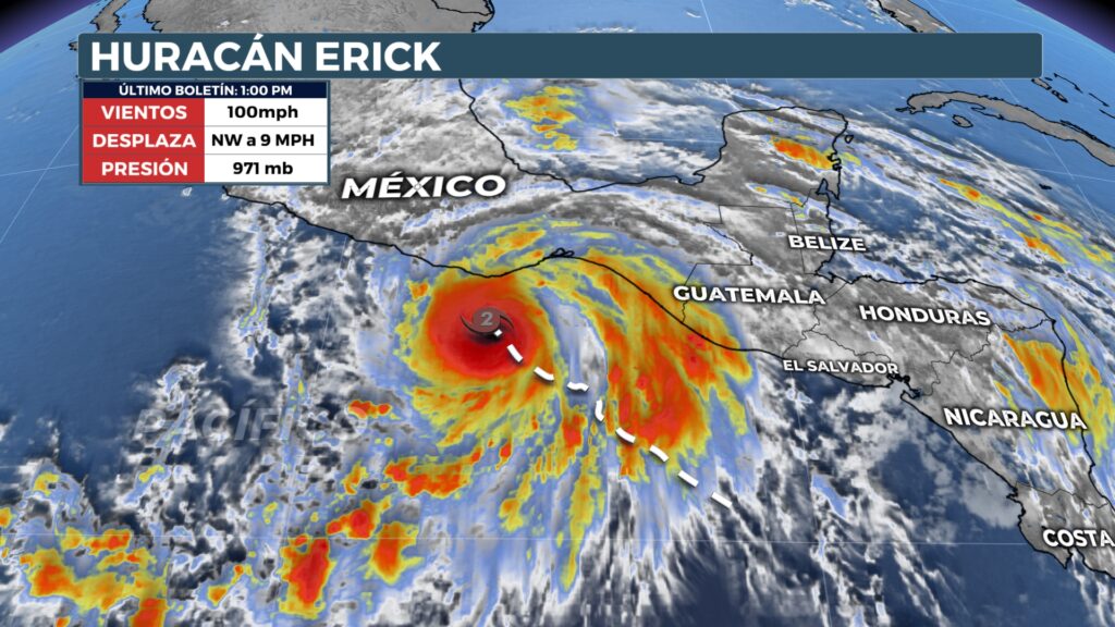
Hurricane Erick became a dangerous Category 4 hurricane as it approached Mexico on Thursday.
Hurricane Erick strengthened rapidly in the hours leading up to landfall, reaching Category 4 while over the warm waters of Mexico.
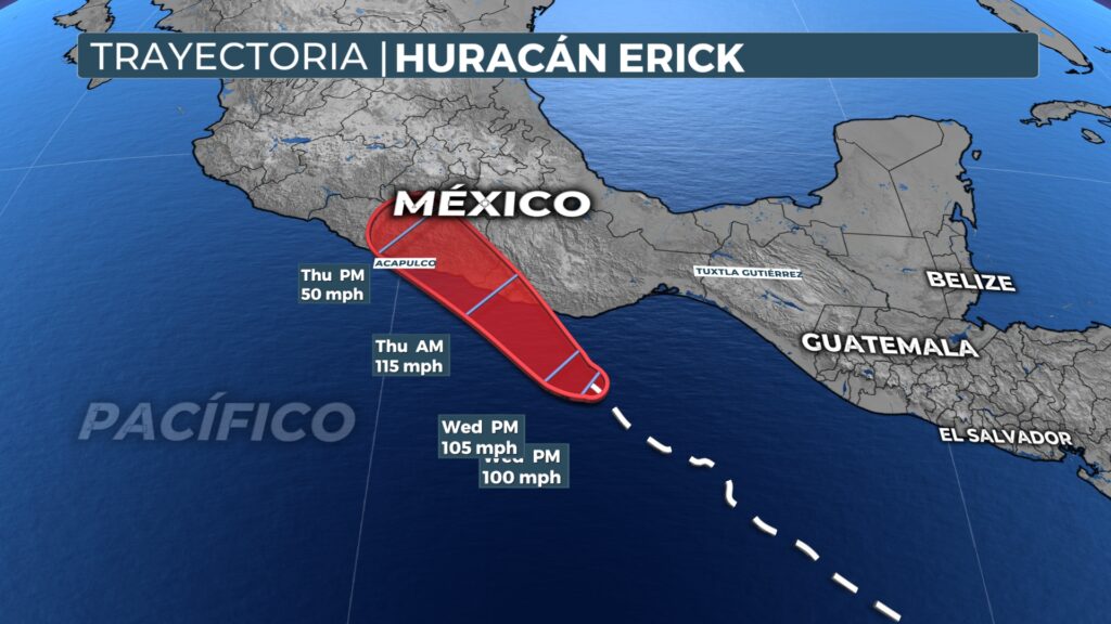
Residents and visitors in coastal communities such as Puerto Escondido and Acapulco were encouraged to take shelter as winds in excess of 125 mph, flash flooding and landslides threatened to create potentially deadly conditions along the country's southwest coast.
The hurricane experienced rapid intensification on Wednesday, which occurs when a tropical cyclone's maximum sustained winds increase to at least 35 mph during the past 24 hours.
As Erick approached Mexico on Wednesday, Hurricane Hunters from the 53rd Air Force Reserve Weather Reconnaissance Squadron flew their first operational mission of the season toward the storm, with the goal of collecting data for the National Hurricane Center.
Although the hurricane looked impressive on satellite imagery, the cyclone was actually quite small in size, with sustained hurricane force winds estimated by Hurricane Hunter aircraft to extend only 25 miles from the center of circulation.
As a major hurricane, Erick will set the record for being the strongest June cyclone to make landfall on Mexico's Pacific coast, which will trigger some memories of Hurricane Otis in 2023.
Otis was the strongest hurricane to ever impact Acapulco, with sustained winds of 165 mph, but due to the unpredictable nature of the cyclone, many were taken by surprise by its fury.
Mexican authorities reported more than 50 deaths and damage estimates in excess of US$10 billion from the late-season disaster.
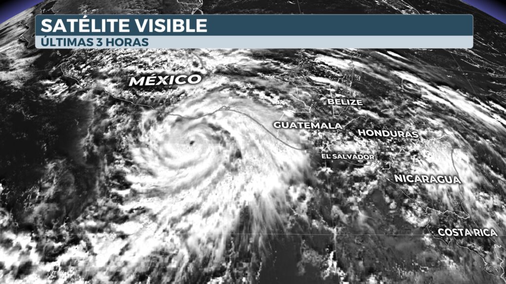
NOAA satellite imagery shows a visible eye developing into a rapidly intensifying Hurricane Erick.
(NOAA / NOAA)
The Mexican government issued a hurricane warning from Puerto Angel to Acapulco, with other tropical weather warnings issued both south and north of the expected landfall location along the country's southern coast.
The mountainous terrain between Mexico City and the coast is expected to quickly unwind the cyclone, but not before landslides and flooding affect inland communities.
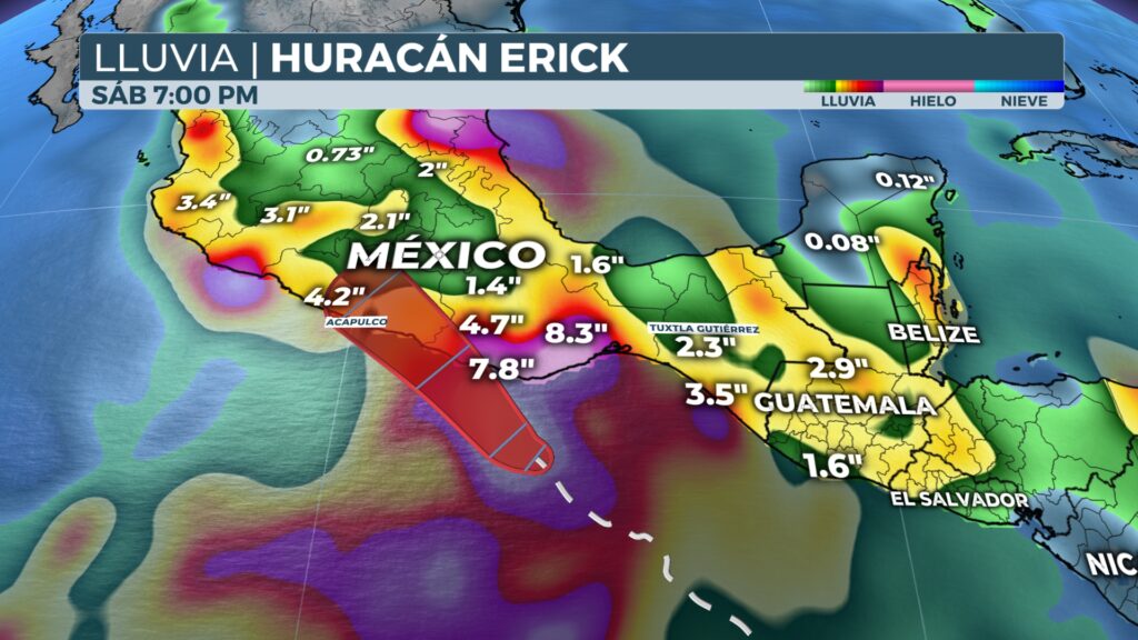
Heavy rains from Hurricane Erick could produce landslides
The NHC forecasts 20 to 40 cm of rain near the coast. Foci of up to 50 cm of rain are possible in the states of Oaxaca and Guerrero.
The NHC warned that heavy rains could produce potentially deadly landslides along the mountainous terrain bordering Mexico's southern coast.
Mexican President Claudia Sheinbaum Pardo took to X on Tuesday to ask residents to be on the lookout for the latest conditions and alerts before the storm makes landfall.