


An extensive area of severe weather off the southeast coast of the U.S. is slowly moving westward across Florida and will leave episodes of heavy rainfall accompanied by flash flood risk through Tuesday. The system is laden with tropical moisture and could evolve into a tropical depression as it moves into the Gulf of Mexico over the next several days.
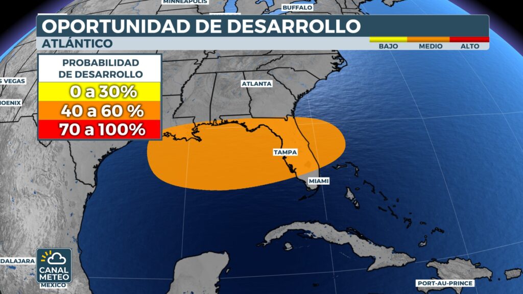
This group of storms has been identified as Invest 93L by the National Hurricane Center. A invest is a designation used to indicate that a system is being monitored for its potential for tropical development.
Heavy rains are expected in Florida, especially along the Gulf Coast and inland areas, with overall accumulations of 2 to 3 inchesalthough in some areas there could be as much as 5 inches locally. Storms could also dump 1 to 3 inches per hour, due to the high moisture concentration.
The NOAA Storm Prediction Center has issued an alert for low risk (level 1 of 5) for severe thunderstorms across the state this Monday, highlighting the potential for damaging wind gusts.
In addition, important rains are expected in other areas of the Gulf of Mexico, such as Alabama, Mississippi and Louisianaincluding the city of New Orleansthroughout this week.
Although conditions in the Atlantic are not conducive to the formation of tropical cyclones, the Gulf has warm temperatures that could lead to the development of a tropical depression. Hurricane hunter aircraft are expected to investigate the system on Tuesday.
For now, the forecast models do not indicate the formation of a strong system.The final intensity will depend on factors such as winds aloft and how long the system remains over warm waters before approaching land. The final intensity will depend on factors such as winds aloft and how long the system remains over warm waters before approaching land.

The National Hurricane Center awards Invest 93L an low probability of development in the next 48 hoursbut a slightly higher probability in the next 7 days.
It is estimated that the system could arrive near Louisiana or Mississippi between Wednesday and Thursdayregardless of whether or not it manages to develop completely. In any case, the main risk will continue to be heavy rainfall, with significant accumulations also in coastal and inland areas of the southern United States.
In the new episode of Atmospheric Turbulence we analyze this developing system, how tropical moisture is affecting Florida and what could happen if a depression forms in the Gulf. We talk about the impact on vulnerable areas, the models being followed and the role of climate change in events like this. Don't miss it! Listen now on your favorite platform and share so that more people are informed.


