

A new streak of several days of rainy weather southeastern United States, generating concerns for flash flooding and ruining another valuable summer weekend on its popular beaches.
Important points
A active cold frontwhich previously caused deadly flooding in the Mid-Atlantic and Northeast, moves to the south during the weekend and will be stationed in the region until well into next week.
Heavy rains on the southeast coast
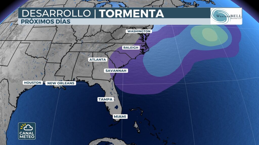
In the area of WilmingtonThe rains have been persistent, affecting outdoor activities and generating conditions conducive to flooding. There are even low probabilities of tropical developmentThe forecast is for an increase in the number of ships in the Atlantic, off the southeast coast or even into the Gulf of Mexico, given the right atmospheric conditions.
The front remains over warm ocean waterswhich could enable it to acquire certain tropical characteristics if it remains stagnant for too long. However, the potential for development remains under for the time being.
Accumulated rainfall and flood risk
Independently of the tropical development, the system has activated a moisture-laden mass of tropical originwhich will result in heavy rainfall in the region.
- Accumulations of 2 to 3 inches (5-8 cm) rainfall in many areas, with total rainfall insulated up to 5 inches (more than 12 cm) at certain points.
- The NOAA Weather Prediction Center has placed parts of Carolinas under level 2 of 4 in flash flood riskwith the risk shifting to the coast of Georgia and South Carolina on Saturday.
The areas with increased risk of receiving more than 3 inches in a 6-hour period include:
- Charleston (SC)
- Savannah (GA)
- Wilmington (NC)
Already on Friday morning, it was reported that water accumulation in streets Wilmington after just 20 minutes of rain.

Persistent weather pattern
During the last month, the heavy and frequent rains have been a constant in the southeast, fed by systems with tropical characteristics. In July, the storm Chantal made landfall off the coast of South Carolina, and at least two more tropical disturbances have crisscrossed the region since then.
Although the flood risk will decrease as of Sundaythe general forecast remains unchanged wet with scattered showers possible at the beginning of next week.