


Important points
Current status and expected developments
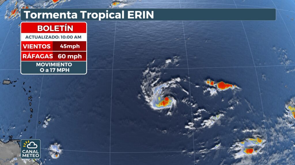
- Training and current displacement: Erin formed Monday in the eastern Atlantic and currently maintains sustained winds of approximately 45 mph (≈ 75 km/h), moving westward at about 30-32 km/h. It is located more than 1 200 miles east of the Windward Islands, moving over increasingly warmer waters .
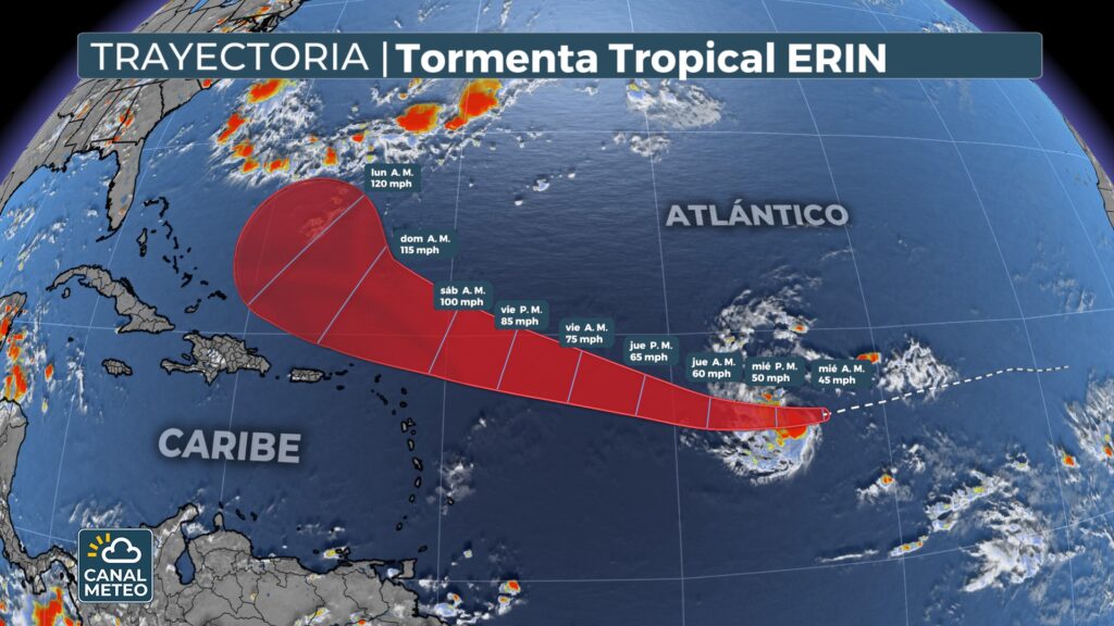
- Planned strengtheningHurricane category: It is expected to intensify over the next few days, probably reaching hurricane status between Thursday and Friday. Projections indicate that it could become a major hurricane (category 3 or higher) by the end of the week.
Track record and areas at risk
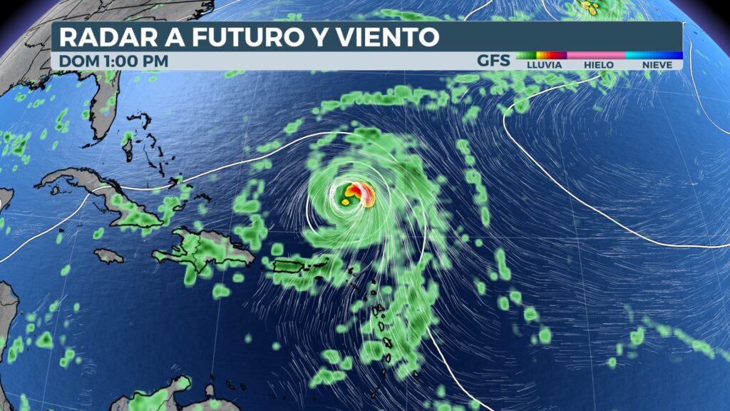
- Erin follows a predominantly westerly course. It is expected to turn northwestward as it progresses, passing near or just north of the Windward Islands, Puerto Rico and the Virgin Islands.
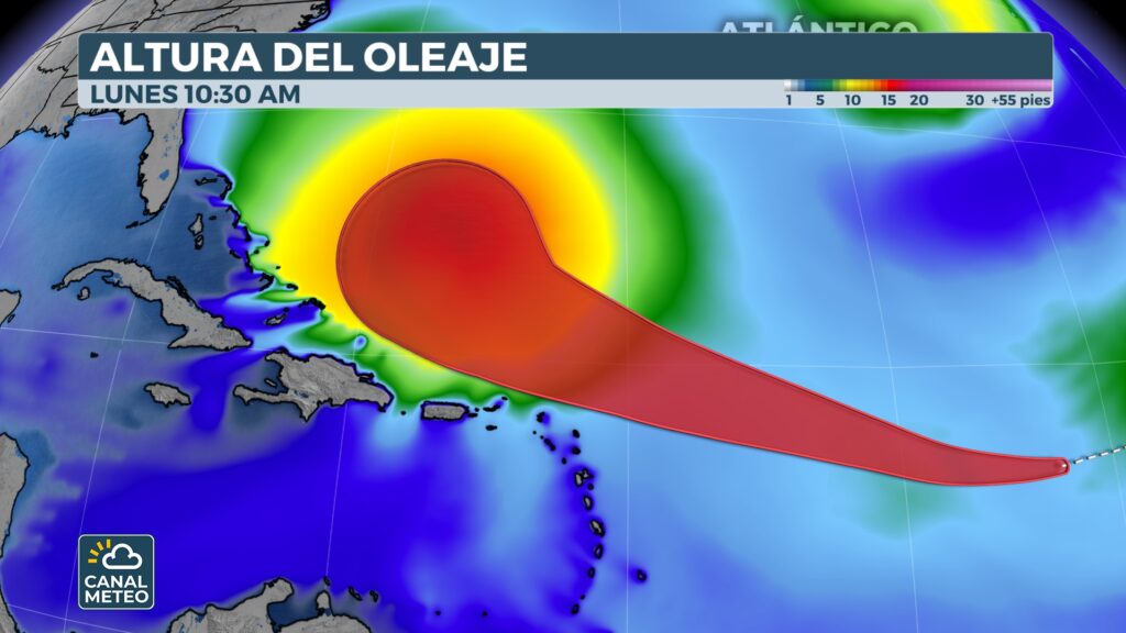
- It is likely to remain offshore, although its swells could generate dangerous conditions such as high surf and rip currents in the coastal areas of the Caribbean and the U.S. East Coast.
- Subsequently, it is expected to curve northward, avoiding the Bahamas and the U.S. mainland coast. However, it could affect indirectly, generating high waves and currents on the Bermuda and Atlantic Canadian coasts.
Additional systems under monitoring
- In the Caribbean Sea, a tropical disturbance is observed in the west of the Yucatan Peninsula that will cross into the Gulf of Mexico. It has a 10 % to 20 % chance of developing over the next few days. Although its direct impact on the U.S. is limited, it could bring scattered showers to Texas, including Houston, between Thursday and Friday.
Weather channel style technical summary
| Element | Main details |
|---|---|
| Training | It formed on Monday in the eastern Atlantic. |
| Intensification | It is expected to become a hurricane between Thursday and Friday; possible category 3 by the weekend. |
| Trajectory | West and then northwest; it may pass to the north of the Antilles and Puerto Rico. |
| Direct impact | Unlikely, but strong surf and dangerous beach conditions are expected. |
| Additional systems | Tropical disturbance in the Caribbean with low possibility of development. |


