Each year, the tropical Atlantic becomes the stage for one of the most powerful forces of nature: the hurricanes. But did you know that they do not form at any time or in any place? The hurricane season follows a very clear pattern, which depends on the progressive warming of the ocean, the prevailing winds and the position of the tropical waves that travel from Africa to America. Throughout the months of June to November, scientists from the National Hurricane Center (NHC) observe how the probability of formation changes, moving from the Gulf of Mexico and the Caribbean to the central Atlantic.
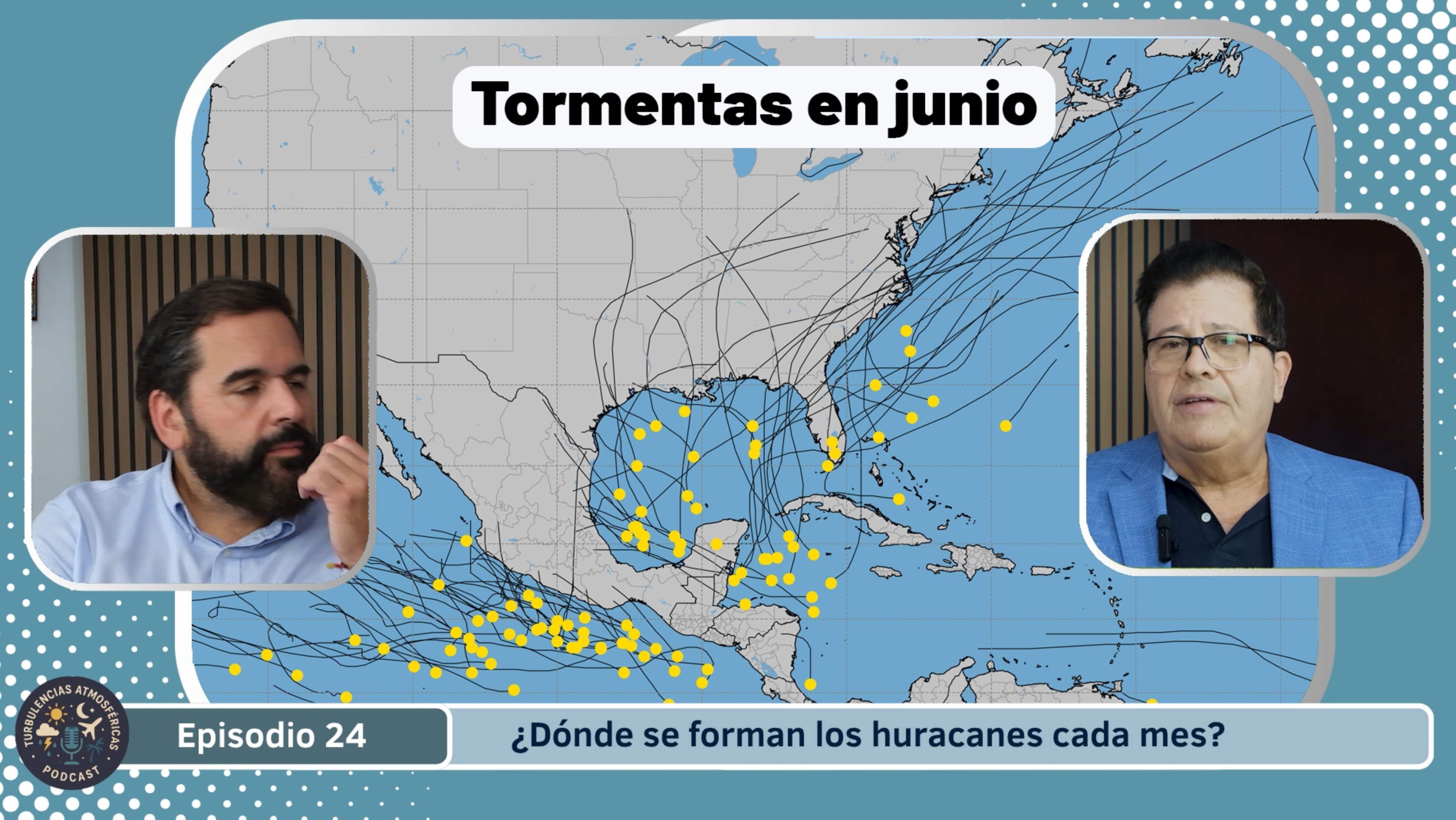
June
The official hurricane season in the Atlantic Ocean begins on June 1 and extends to the November 30. In June, favorable conditions are still being established: the tropical waters of the Atlantic and Caribbean begin to warm, but wind shear (changes in speed or direction with height) is usually still relatively high and stabilizes the atmosphere. As a result, tropical cyclones that form in June usually originate in the western Caribbean Sea or Gulf of Mexico, with less elongated paths into the open Atlantic. Even so, it is important to be prepared from this month, because although the activity is moderate, any system that is organized can evolve.
July
In July the activity is increasing. The waters are warmer, tropical disturbances coming from Africa (tropical waves) begin to have more “fuel” to develop, and shear tends to decrease in some areas. The origin of most cyclones at this time moves eastward from the Caribbean and Lesser Antilles, potentially moving northward or northwestward. Although the maximum level of activity is not yet reached, July marks the entry into the most active period.
August
August is when the season really “takes off”. According to climatology, between August and early October most hurricanes are produced. The waters of the open Atlantic (the “Main Development Region”, MDR, between Africa and the Caribbean) reach their maximum temperatures, shear decreases, and tropical waves travel more directly into these warm waters, which facilitates the formation of tropical storms that can intensify. At this stage, systems may form farther east and then move into the Caribbean, Gulf of Mexico, or move up the east coast of the U.S. or Canada.
September
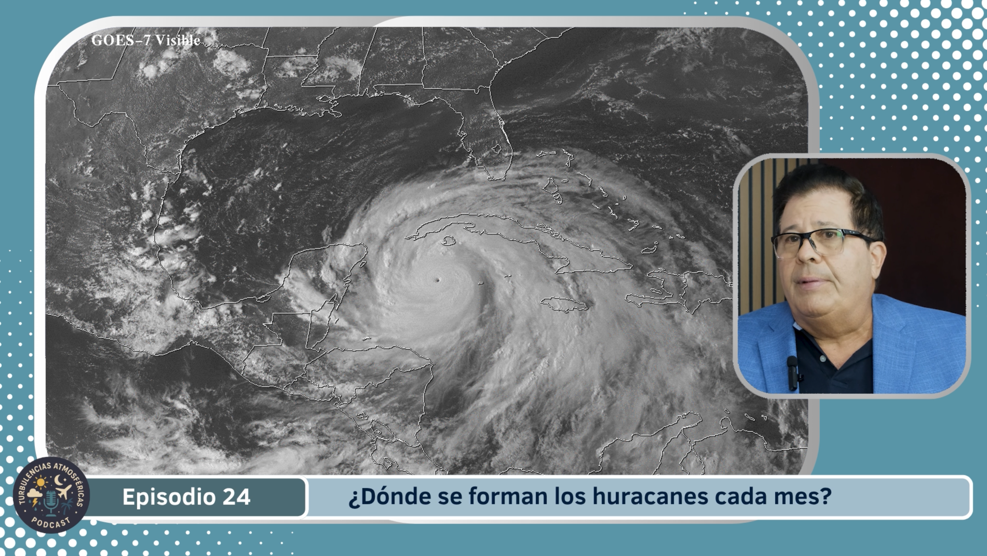
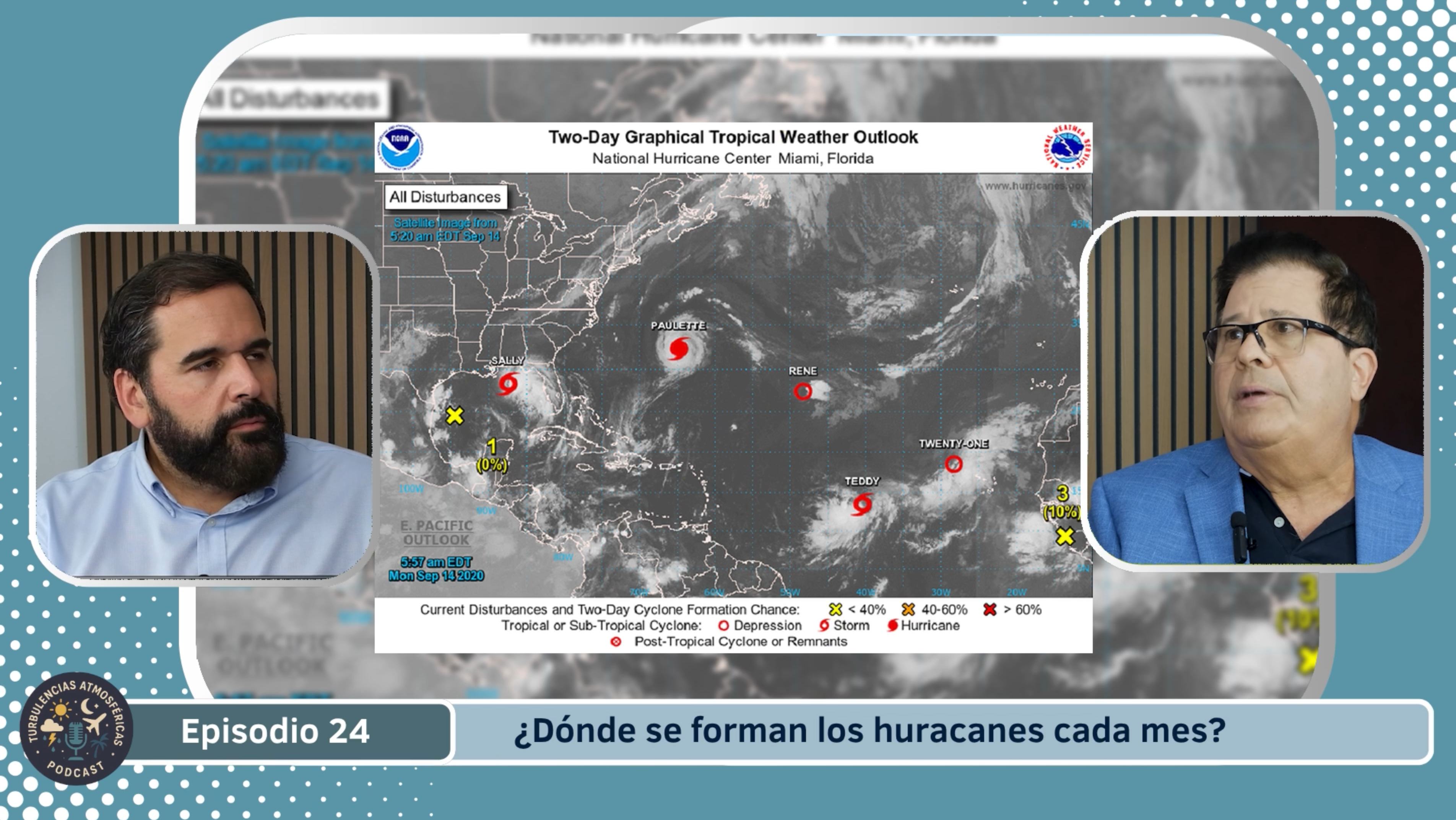
In September, the climatological peak of the season. Historically, September 10 is the most active day (in terms of named storms) in the Atlantic basin. During this month all the factors combine: very warm waters, low shear, high humidity, and abundant disturbances. Formation occurs in the open Atlantic as well as in the Caribbean and Gulf, and hurricanes can reach great intensity. After this peak, activity begins to decrease, but remains high at least through October.
October
In October, activity continues to be relevant, but the origin of hurricanes is already shifting towards the Caribbean and the Gulf of Mexico rather than the open Atlantic. The waters are still warm, but shear is gradually increasing and conditions are less ideal than in August-September. Still, strong hurricanes may form, even through the end of the month. There is also talk of a minor “second peak” around mid-October.
November
November marks the close of the season. Although most hurricanes have already occurred, the risk doesn't disappear until the season ends on November 30. At this time the number of formations drops significantly, the waters cool, the shear increases and the atmosphere stabilizes, which reduces the frequency of cyclones. But occasional systems may still form, especially in the western Caribbean or the Gulf of Mexico.
You can listen to more episodes of our podcast "Atmospheric Turbulence" and follow all the weather and climate coverage at Meteo TV Channel. Find us at canalmeteo.tv, Don't miss the next chapters and stay informed with Canal Meteo!