The National Hurricane Center (NHC) is closely monitoring the evolution of Invest 94L in the Atlantic. Forecasters indicate that there is a high probability that it will become a tropical depression or even a tropical storm during the next few days, with possible effects on the east coast of the United States.
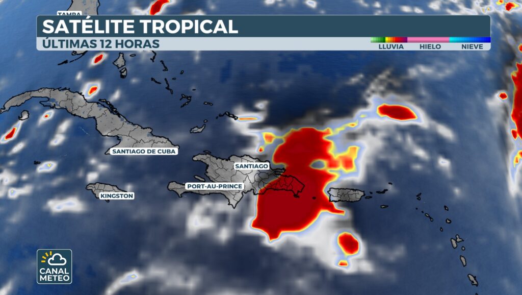
Although the exact track remains uncertain, the NHC warned that people in the southeastern part of the country should be on the lookout for this system. Currently, Invest 94L is near the Dominican Republic and is producing an extensive area of disorganized showers and thunderstorms, as well as strong winds affecting much of Hispaniola and Puerto Rico.

The tropical wave is forecast to move west-northwestward at a speed of 10 to 15 mph, generating heavy rains and gusts over Puerto Rico and the Dominican Republic. Subsequently, it is expected to slow down and turn northwestward as it reaches the southwest Atlantic, where a tropical depression is likely to form near the Bahamas.
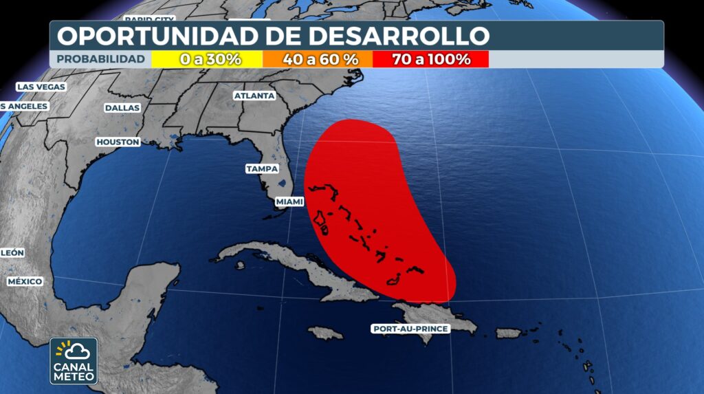
The NHC advised that those with interests in the Virgin Islands, Puerto Rico, Dominican Republic, Turks and Caicos Islands, Bahamas and the southeastern U.S. should monitor the progress of this system.
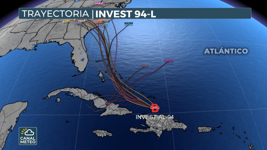
NOAA has deployed hurricane hunter aircraft to collect data at different levels of the atmosphere to improve the accuracy of forecast models of future trajectory and intensity.