
A explosive cyclogenesis is approaching the Northeastern United States and could become the most significant snowstorm in years for cities such as New York and Boston. The system will arrive beginning Sunday afternoon and will leave accumulations that could exceed a foot of snow in several states.
What is an explosive cyclogenesis?
We are talking about explosive cyclogenesis when the central pressure of a storm drops 24 millibars in less than 24 hours. This process, known in English as bombogenesis, The storm, turns an ordinary squall into a very high intensity system with devastating winds and extreme precipitation. When this occurs over the Atlantic combined with a flow of cold air from the northeast -a nor'easter- The result could be one of the most dangerous winter storms to hit the East Coast of the United States.
Trajectory and arrival of the storm
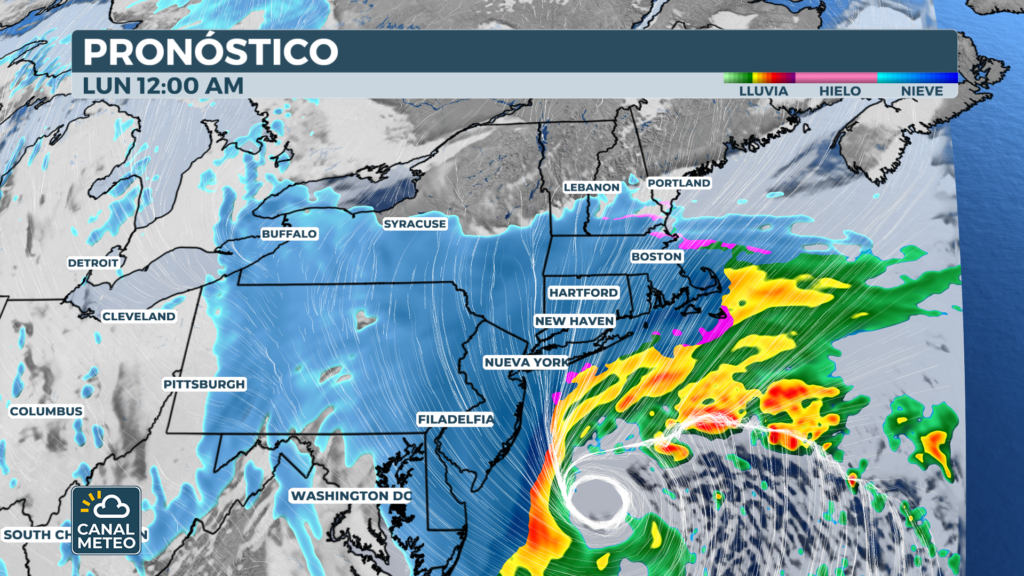
The storm will begin to organize Sunday afternoon off the North Carolina coast. As low pressure rapidly intensifies over the Atlantic, snowfall will sweep the Interstate 95 corridor from Virginia to Maine beginning Sunday night.
The key to the impact will be the proximity of the trajectory to the coast: the closer, the greater the accumulation of snow in large cities.
Expected accumulations by city
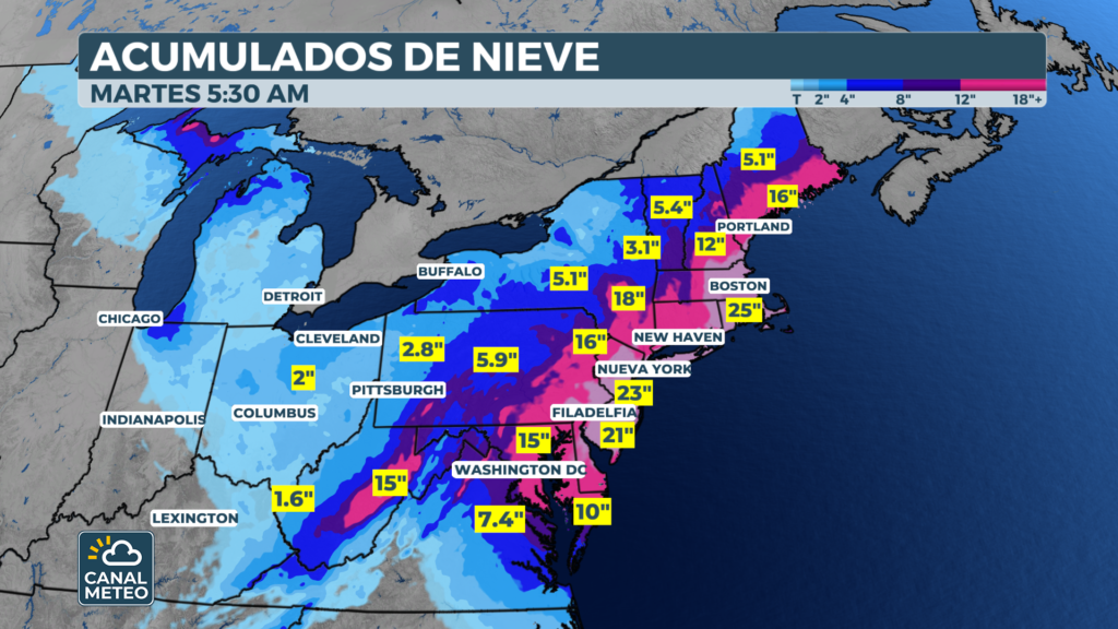
Projections have increased in recent days and point to historic figures:
- New York and Boston: between 12 and 18 inches
- Philadelphia: between 8 and 12 inches
- Baltimore: between 8 and 12 inches, in the middle of the impact center
- Washington D.C.: between 5 and 8 inches, although the prognosis remains uncertain.
Inland areas will receive smaller accumulations.
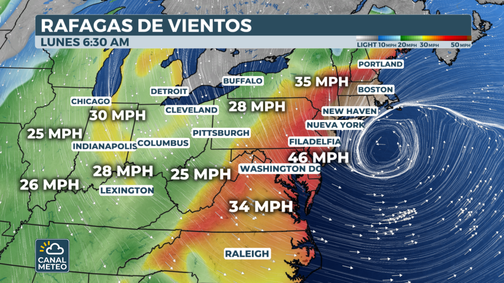
Winds up to 70 mph and blizzard risk
Explosive cyclogenesis will not only bring snow. Winds could reach gusts of up to 70 mph, combined with the heavy snowfall, this could lead to severe snow conditions. blizzardhttps://es.wikipedia.org/wiki/Ventisca in southeastern Massachusetts and Rhode Island. A blizzard is defined as a storm with sustained winds of at least 35 mph, visibility less than 1/4 mile and a minimum duration of three hours. Massive power outages are a real threat throughout the region.
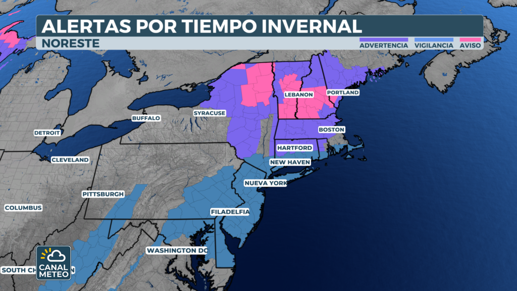
Winter storm warnings now in effect
The meteorological authorities have issued Winter Storm Warnings for New York, Long Island, parts of New Jersey - including the Jersey Shore - Connecticut, Massachusetts and Baltimore. Boston is also under a Coastal Flood Warning.
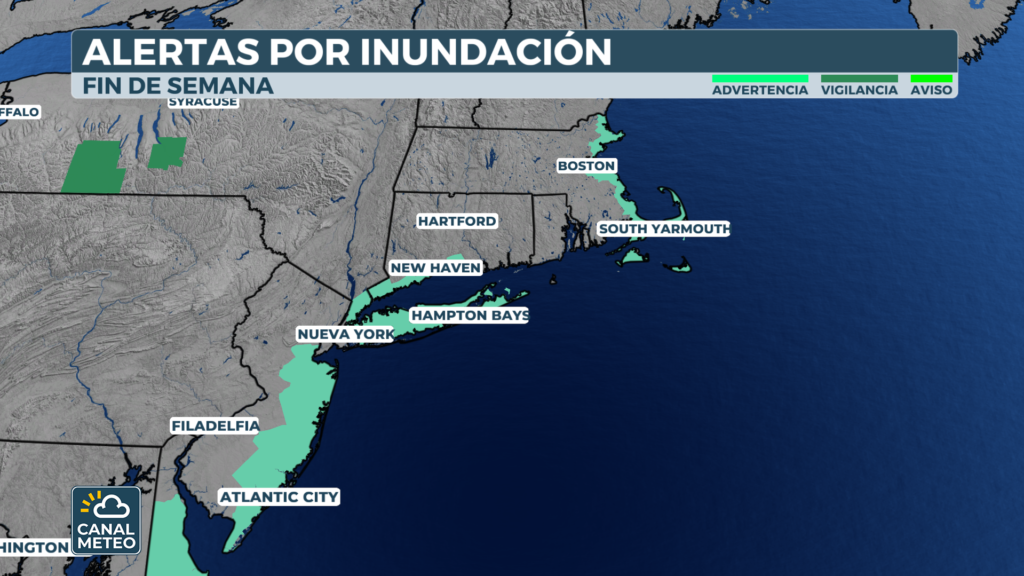
The combination of heavy surf and northeasterly winds will raise sea levels at high tide, causing moderate to severe flooding in eastern Massachusetts. Waves will also cause significant coastal erosion from Cape Cod to the Outer Banks of North Carolina.
Transportation severely affected
The impact on mobility will be severe. Airlines such as JetBlue, American Airlines, Delta, Southwest and United have activated flight change waivers at major airports in the Northeast. Amtrak is closely monitoring the trajectory and has warned that it may adjust service in the Northeast corridor.
Several stretches of I-95 and local roads will be snow-covered, paralyzing traffic starting Sunday night.
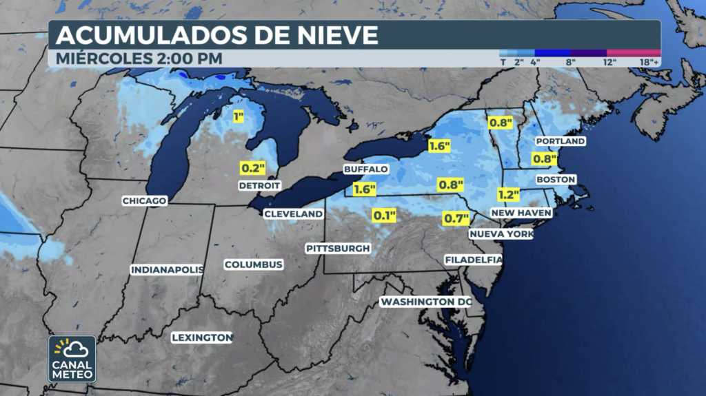
When will the storm end?
In New York and areas to the west, the snow will subside during the day on Monday. Long Island and Maine will remain under snow through Monday night. By Tuesday morning, explosive cyclogenesis will have left the Northeast completely.
Stay informed with the latest updates from Canal Meteo and prepare your home and vehicle emergency kit in advance before the storm hits.
Remember that you can see weather channel here.