After a volatile April, an unstable pattern takes shape across the Midwest and South. Millions will face damaging winds, large hail, tornadoes, and a risk of flash flooding.
It should be remembered that in the last month alone, more than 260 tornadoes were reported in the central U.S. The highest concentration was registered over the Midwest. Many of the areas affected last month will once again be in the risk zone, including portions of Missouri, Iowa, Illinois, Oklahoma, and Texas.
Monday: Storms reach the Midwest and Great Lakes
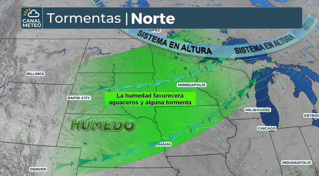
On Monday, thunderstorms will reach the northern Midwest, the Ohio Valley, and the Great Lakes between the afternoon and evening. The cold front will push the system south as the day progresses.
NOAA's Storm Prediction Center (SPC) upgraded the threat to a Level 2 of 5 for eastern Kansas, northern Missouri, and western Illinois. That includes Kansas City and Springfield. The main threats will be damaging wind gusts and hail.
On the other hand, Chicago, Milwaukee, and St. Louis are under a Level 1 risk.
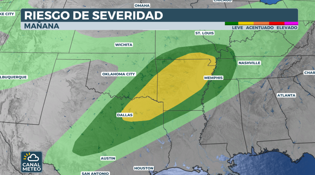
Tuesday and Wednesday: The risk shifts to the Deep South
The front is expected to stall over the Southern Plains and the South between Tuesday and Wednesday. This will trigger multiple rounds of severe thunderstorms on those days.
On Tuesday, a Level 2 risk covers parts of North Texas, including Dallas, along with eastern Oklahoma and Arkansas. Large hail, damaging winds, and tornadoes will be possible with any storms that develop.
Later, on Wednesday, the threat shifts south towards the Ark-La-Tex region, Mississippi, and Alabama. Consequently, residents in these areas should remain vigilant throughout the week.
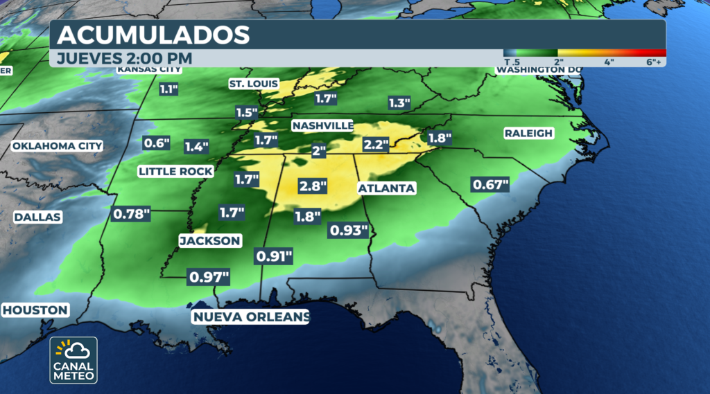
Intense rains batter from the Ohio Valley to the Northeast
This atmospheric setup will also bring several days of heavy rain. The precipitation will begin Monday night and continue through Wednesday, impacting areas from Kansas to Ohio. The heaviest rain is expected between Tuesday and Wednesday.
Due to the slow-moving front and the risk of repeated storms over the same areas, there is a Level 1 out of 5 risk of flash flooding on Tuesday. The threat spans from eastern Tennessee into southern Indiana.
Starting Wednesday, those heavy rains will expand from the Tennessee Valley into the Ohio Valley and the Northeast. Downpours could cause delays at major airports along the Interstate 95 corridor.
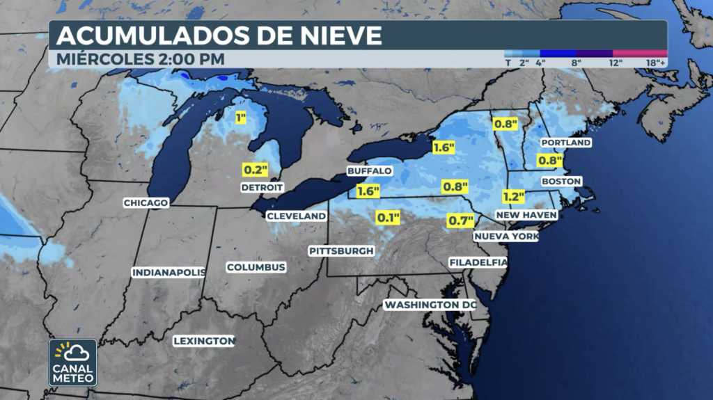
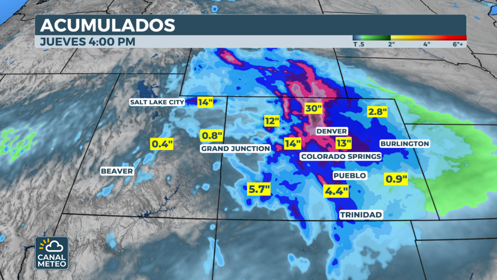
Late snow: up to 2 feet in the Rocky Mountains
Behind the cold front, frigid air will dump abundant snow on the central Rockies. The greatest accumulations are expected in the mountains of Wyoming and Colorado. Some of the highest peaks and passes could receive 1 to 2 feet of heavy, wet snow.
In Colorado, widespread accumulations of 8 to 12 inches are expected in the northern and central mountains. This includes popular areas like Breckenridge and Rocky Mountain National Park.
Additionally, a Winter Storm Warning is in effect for Denver from Tuesday through Wednesday. Snow will clear out Thursday, but it will leave behind temperatures more typical of early March for Denver and the eastern two-thirds of the country.
Will the storms calm down in May?
According to NOAA's outlooks, a pattern change suggests May could be calmer following April's destructive streak. However, this severe cold front across the U.S. shows the severe weather season is far from over.
Likewise, meteorologists point out that El Niño could boost storm activity in the Atlantic as hurricane season approaches. At Canal Meteo TV, we will continue to report on every development.
In summary, this Severe cold front USA. presents a multi-threat to millions of people this week. Storms, rain, and snow will impact much of the country. We recommend following the NWS's guidance and preparing in advance. For the most up-to-date information, visit Meteo TV Channel.
To better understand how cold fronts work and their associated dangers, consult this guide from National Weather Service (NWS).
Explore more articles about Extreme weather on our site.