
Persistent rains this weekend in the Mid-Atlantic and Northeast
Millions of people in the eastern U.S. are preparing for several days of intense storms, heavy rains and risk of severe weather. Two consecutive systems will move across the country from west to east starting Thursday.
The first of these systems will begin to develop in the southwest and move rapidly toward the center of the country. The second will take shape on Friday, increasing the risk of severe storms in the south and southeast.

Back-to-back storms will affect much of the eastern U.S.
Two storms will cross the country in a few days. They will bring heavy rains, thunderstorms and episodes of severe weather. The risk will begin in the center of the country and move eastward as the week progresses. From Thursday, the following are expected several rounds of heavy rain in the Midwest and in the valleys of the Ohio, Tennessee and Mississippi. The situation will become more complicated on Friday.
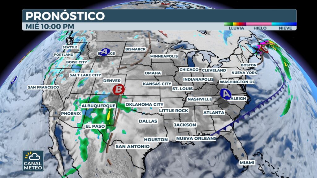
Wednesday: first system organizes in the southwest
The first system will begin to form on Wednesday in the southwest. continuous rains in areas of Arizona y New Mexico, including Phoenix, Tucson and Albuquerque. Prior to his arrival, a cold front will activate storms in the Southern Great Plains. The risk will affect Oklahoma y North Texas from Wednesday afternoon. The main threats will be strong gusts of wind y hail.
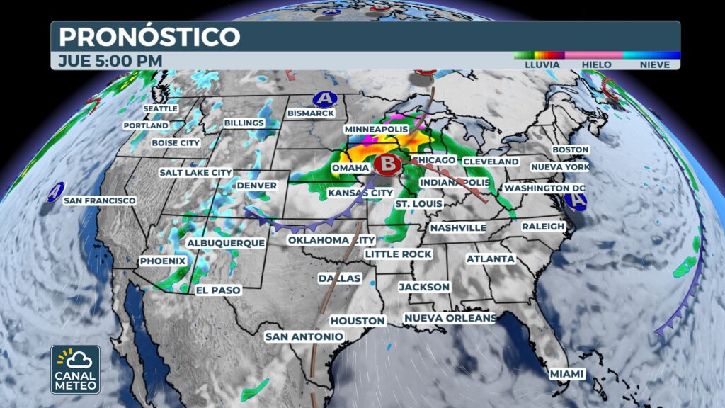
Thursday: storm crosses the center of the country
On Thursday, the system will advance quickly from Southern Rocky Mountains.
Widespread rainfall is expected in the Southern Plains.
The heaviest rainfall could occur in Oklahoma, Kansas and Missouri during the morning.
In the afternoon, the rain will spread to the Midwest, affecting Illinois, Wisconsin, Indiana and to the Ohio Valley.
During the day, the following will take place several rounds of storms in the Mississippi Valley.
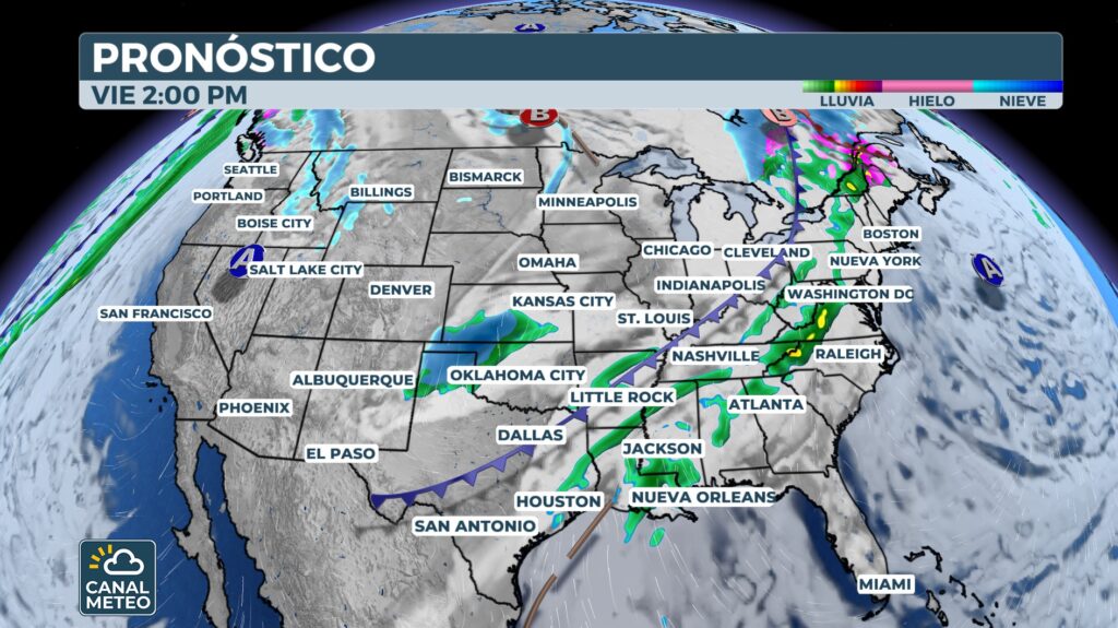
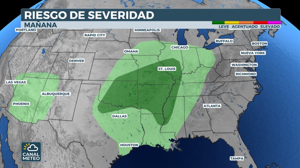
Friday: Risk of severe weather increases in Deep South
Friday will be the most sensitive day. The cold front associated with the first system will arrive to the Deep South, increasing the risk of severe storms. More about 8 million people will be under a moderate risk of strong storms.
The most affected areas include parts of Louisiana, Arkansas, Mississippi, Alabama, Mississippi, Alabama y West Tennessee. Cities such as Memphis, Jackson y Baton Rouge could be affected. The storms could produce damaging winds, large hail y some tornadoes.
That same Friday, a second system will be formed again in the region of the four corners. This will again generate rainfall in areas that are already saturated.
Risk of flash floods
In addition to severe weather, there is concern about amount of accumulated rainfall. Between Friday and Saturday, the following could be registered more than 2 to 3 inches of rain in parts of Tennessee, Northeastern Mississippiy North Alabama. This increases the risk of flash flooding, especially in urban areas and mountainous zones. The metropolitan area of Nashville is very close to this elevated risk.
Rains Reach Northeast and New England
The rainfall from the first system will reach the Northeast Friday morning. They will affect cities such as Washington D.C., Philadelphia, New York and Boston. On Saturday, rains will continue in most of the country. Southeast. In the afternoon, the second system will move towards the region of the Great Lakes.
The following are expected showers and thunderstorms along the coast of the Northeast and New England for much of Saturday. Conditions will begin to improve Sunday afternoon. Most of the areas could dry on Monday.